Archived Storm Damage Blog Posts
Lightning Safety Tips: Protecting Yourself and Your Property
6/26/2024 (Permalink)
 Stay Safe During Storms!
Lightning strikes are a natural and awe-inspiring phenomenon, but they can also be incredibly dangerous. Each year, lightning causes numerous injuries, fatalities, and property damage. Our team prioritizes your safety and well-being. Here are some essential lightning safety tips to help you stay safe and protect your property during thunderstorms.
1. Stay Indoors During Storms
The safest place to be during a thunderstorm is indoors. As soon as you hear thunder, seek shelter immediately. Avoid using electronic devices connected to wall outlets, as lightning can cause power surges. If you're inside a building, stay away from windows, doors, and any metal objects that can conduct electricity.
2. Avoid Water and Plumbing
Water is an excellent conductor of electricity. During a thunderstorm, avoid using plumbing fixtures such as sinks, bathtubs, and showers. Lightning can travel through pipes and water systems, posing a risk of electrocution.
3. Unplug Electronics
To protect your electronics from power surges caused by lightning strikes, unplug them before the storm hits. This includes computers, televisions, and other valuable devices. Using surge protectors can also help reduce the risk of damage.
4. Avoid Outdoor Activities
If you’re caught outside during a thunderstorm, find shelter immediately. Stay away from open fields, hilltops, and bodies of water. Avoid tall objects like trees, poles, and metal fences, as they attract lightning. If no shelter is available, crouch low to the ground with your feet together and minimize contact with the ground.
5. Stay in Your Car
If you’re driving when a thunderstorm begins, stay in your vehicle. Cars provide good protection against lightning due to their metal frame. However, avoid touching metal surfaces inside the car during the storm.
6. Wait It Out
Wait at least 30 minutes after the last clap of thunder before leaving your shelter. Thunderstorms can produce multiple lightning strikes even after they seem to have passed.
7. Prepare Your Home
Install lightning rods on your home to direct strikes safely into the ground. Ensure that your home’s electrical system is grounded correctly. Regular maintenance and inspection of these systems can help reduce the risk of lightning-related damage.
8. Know the Signs
If you see dark, towering clouds and hear distant thunder, take it as a sign to prepare for a potential thunderstorm. Stay informed about weather conditions through reliable sources and follow any advisories or warnings.
9. Educate Your Family
Teach your family members about lightning safety and create a plan for what to do during a thunderstorm. Ensure that everyone knows the safest places to seek shelter and the actions to avoid.
10. After the Storm
Once the storm has passed, inspect your property for any damage. If you notice any issues such as electrical problems, water leaks, or structural damage, contact professionals for immediate assistance. SERVPRO Team Spinner is here to help with post-storm cleanup and restoration, ensuring your home returns to its safe and comfortable state.
Be Prepared and Stay Safe
Lightning safety is crucial for protecting yourself, your loved ones, and your property. By following these tips, you can reduce the risk of injury and damage during thunderstorms. If your property does suffer damage from a lightning strike, trust our team to provide prompt and professional restoration services.
Stay safe, stay informed, and remember that SERVPRO Team Spinner is here to help you through any storm. Contact us for assistance with storm damage restoration and ensure your home is always protected.
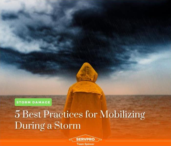
5 Best Practices for Mobilizing During a Storm
5/3/2024 (Permalink)
 You've got a big storm coming? Here's what to do.
As a leader in disaster recovery and mitigation, SERVPRO Team Spinner understands the importance of preparation and readiness when it comes to severe weather events. Whether it's a hurricane, tornado, or severe thunderstorm, mobilizing effectively can make all the difference in ensuring the safety of yourself, your loved ones, and your property. In this blog post, we'll share five best practices for mobilizing during a storm, along with a call to action to encourage proactive preparedness.
1. Stay Informed: Keeping informed about weather forecasts and updates is essential for making informed decisions during a storm. Use reliable sources of information such as NOAA Weather Radio, weather apps, or local news outlets to stay abreast of changing weather conditions and potential risks.
2. Prepare an Emergency Kit: Assemble an emergency kit containing essential supplies such as non-perishable food, water, flashlights, batteries, first aid supplies, medications, and important documents. Make sure your kit is easily accessible and includes enough provisions to sustain you and your family for at least 72 hours.
3. Secure Your Property: Take proactive measures to secure your home and property against potential damage. Reinforce doors and windows, trim trees and shrubs, and secure outdoor furniture and equipment. Consider installing storm shutters or boarding up windows to protect against high winds and flying debris.
4. Have a Communication Plan: Establish a communication plan with family members, neighbors, and loved ones. Designate a point of contact outside the affected area who can serve as a central coordinator for communication and information sharing. Ensure that everyone knows how to reach each other in case of separation or evacuation.
5. Follow Evacuation Orders: Heed evacuation orders issued by local authorities. If instructed to evacuate, do so immediately and follow designated evacuation routes to safety. Take only essential items with you and leave early to avoid traffic congestion and hazardous conditions.
Don't wait until the next storm is on the horizon to prepare. Take action now to ensure that you and your loved ones are ready to weather any storm that comes your way. Browse our website for more information on storm preparedness and to learn how our team can help you recover and rebuild in the aftermath of a severe weather event. Together, we can weather the storm and emerge stronger on the other side.
Be Prepared: Simple Storm & Flood Tips That Could Save You in an Emergency
10/2/2023 (Permalink)
Natural disasters can strike unexpectedly, and when they do, it's essential to be prepared. Storms and floods are among the most common weather-related emergencies that homeowners face. At SERVPRO of Central Union County, we understand the importance of being proactive in protecting your home and loved ones. In this blog post, we'll share simple yet effective storm and flood preparedness tips that can make a significant difference during an emergency.
1. Create an Emergency Kit:
A well-prepared emergency kit can be a lifesaver during a storm or flood. It should include essential items such as non-perishable food, water, flashlights, batteries, a first-aid kit, blankets, and important documents (e.g., identification, insurance papers). Make sure your kit is easily accessible and up to date.
2. Stay Informed:
Keep yourself informed about weather forecasts and potential storm warnings. Sign up for weather alerts on your smartphone and have a battery-operated weather radio on hand. Knowing when a storm or flood is expected can give you valuable time to prepare or evacuate if necessary.
3. Secure Your Property:
Before a storm hits, take preventive measures to secure your property. Trim overhanging branches and clear debris from gutters and downspouts to prevent water damage. Consider investing in storm shutters or impact-resistant windows to protect against high winds and flying debris.
4. Elevate Important Items:
If you live in a flood-prone area, elevate valuable items and utilities in your home. Move electrical systems, appliances, and valuable possessions to higher floors or platforms. Elevating your furnace, water heater, and electrical panel can minimize damage.
5. Have an Evacuation Plan:
Develop a family evacuation plan in advance. Identify safe evacuation routes and meeting points. Ensure that everyone in your household knows the plan, including how to turn off utilities if needed. Don't forget to include your pets in your evacuation plan.
6. Protect Your Basement:
Basements are especially vulnerable to flooding. Install a sump pump and consider a battery backup system to prevent water buildup. Waterproof your basement walls and floors to minimize water infiltration during heavy rains.
7. Insurance Check-Up:
Review your homeowner's insurance policy to ensure you have adequate coverage for storm and flood damage. Understand your policy's terms, limitations, and deductible. Consider adding flood insurance if you are in a flood-prone area.
8. Stay Safe During the Storm:
During the storm, stay indoors, away from windows, and avoid using electrical appliances. If the authorities issue an evacuation order, follow it promptly. Never attempt to drive through flooded roads, as it's difficult to gauge the water's depth and strength.
By following these simple storm and flood preparedness tips, you can significantly improve your ability to weather the storm and protect your home and loved ones. Remember that safety should always be the top priority. In the event of storm or flood damage, SERVPRO of Central Union County is here to help you with water damage restoration and cleanup. Stay informed, stay safe, and be prepared for whatever Mother Nature may bring your way.
Have Storm or Flood Damage? Call Us Today - (908) 650-8611
After the Storm: Key Steps for Handling Storm Damage
8/28/2023 (Permalink)
Storms can be unpredictable and unforgiving, leaving behind a trail of destruction. As a homeowner, it's crucial to know what steps to take once the storm has passed. At SERVPRO, we're here to guide you through the process of handling storm damage efficiently and effectively. In this blog, we'll outline a few key steps to take after a storm has swept through your area.
Ensure Safety First
Before you even begin assessing the damage, prioritize safety. Check for downed power lines and gas leaks, and report them immediately to the appropriate authorities. Be cautious of standing water, as it may be electrically charged or hiding hazards underneath.
Contact Your Insurance Provider
Next, get in touch with your homeowner's insurance provider as soon as possible. Inform them of the damage and initiate the claims process. Document the damage by taking photos and videos; this will be helpful during the claims assessment.
Assess the Damage
Once it's safe to do so, assess the damage to your property. Start with the exterior and work your way inside. Look for:
- Roof damage: Check for missing shingles or visible signs of leaks.
- Structural damage: Inspect walls, foundations, and ceilings for cracks or shifting.
- Water damage: Look for signs of water intrusion, such as dampness, stains, or mold growth.
- Flooding: If your home has experienced flooding, document the water level and extent of damage.
- Fallen trees and debris: Assess any damage caused by fallen trees or debris.
Mitigate Further Damage
Take steps to prevent further damage to your property. If you find a damaged roof, cover it with a tarp to prevent rainwater from entering your home. Remove debris carefully, but avoid doing any major repairs until your insurance adjuster has assessed the damage.
Contact SERVPRO
For professional storm damage restoration, contact SERVPRO. We have the expertise and equipment to handle storm damage efficiently. Our services include water extraction, drying, mold remediation, and structural repairs. We'll work closely with your insurance provider to streamline the restoration process and get your home back to normal as quickly as possible.
Document Everything
Maintain thorough documentation throughout the process. Keep records of all communications with your insurance provider, contractors, and SERVPRO. Save receipts for any expenses related to temporary repairs or accommodations if you cannot stay in your home.
Dealing with storm damage can be overwhelming, but with the right steps and professional assistance, you can rebuild and restore your home. Remember that safety should always be your top priority. At SERVPRO, we're here to help you through the storm damage restoration process. Contact us today, and we'll be on hand to assess, mitigate, and restore your property, so you can get back to your normal life as soon as possible.
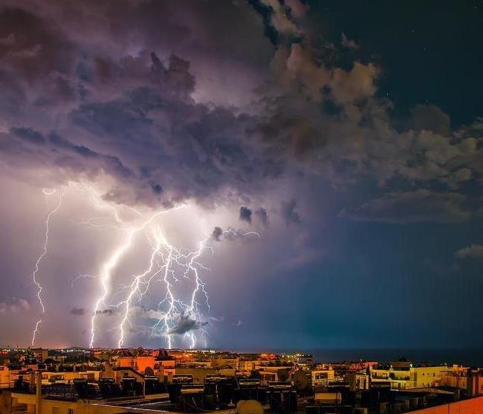
How to Stay Safe in a Thunderstorm
11/2/2022 (Permalink)
 Follow these tips to stay safe in a thunderstorm.
SERVPRO of Central Union County cares gratefully about the safety of our customers. Thunderstorms can be a scary and overwhelming event. Here are some safety precautions that can be taken to insure your well-being.
- Keep yourself updated with news reports by listening to your local weather radios.
- When inside, stay off corded phones, computers, and other electronic equipment that put you in direct contact with electricity or plumbing.
- Unplug any appliances or electrical items such as TVs, computers, and air conditioners. If you are not able to unplug, turn it off.
- Secure any doors and shutters. Make sure that you remove any dead or rotting branches from trees that could potentially fall and cause damage to your home or anyone.
Remember, Storm damage is likely to occur depending on the intensity of the storm. For any services you may need whether an emergency or a quote, please feel free to give us a call at (908) 233-7070
Source: http://www.jacksontwp.com
Understanding the Basics of Damaging Winds
11/2/2022 (Permalink)
Damaging winds are one of the threats that comes with severe storms. These winds can catch you off guard and be problematic due to long-term structural impacts.
Why Damaging Winds Are Such a Major Concern
Tornadoes and hurricanes are not the only times damaging winds occur. Damaging winds are considered winds with wind speeds exceeding 50–60 mph and can be produced by a strong thunderstorm. Often, you will hear damaging winds referred to as “straight-line” winds to differentiate the damage from tornado damage.
The damage from straight-line winds can be especially destructive, often causing unanchored objects to become projectiles. Any windows or roof can take the brunt of this damage. If the damage is extensive, it can result in water damage to the home as outside elements come indoors through broken windows or damaged roofs.
Anyone who lives in a thunderstorm-prone area can be at risk from damaging winds, but there are some structures, such as mobile homes, especially at risk. Mobile homes, even those that are anchored, could sustain serious damage in winds gusting over 80 mph.
Ways to Prepare Your Home
There are a number of things you can do to protect your property from damaging winds, but there are two things to remember, keeping the “Two R’s” in mind: reinforce and remove.
Look into having your garage door reinforced by a professional.
Ensure that any loose objects on your property that could become wind-borne are properly stored or anchored. Remember that trash cans, grills and outdoor furniture are easily picked up by strong winds.
Larger, older decaying trees and branches should be professionally removed, which will ensure they cannot be blown onto your home.
Remember, high winds can occur without advanced notice. By taking some, or all, of the above actions, you can be prepared on a moment’s notice.
Also, if you are building a new home or renovating an older home, be sure windows, walls and doors are up to code for your area.
If your home has been hit by damaging winds and resulting water damage, the highly trained specialists at SERVPRO® of Central Union County & SERVPRO® of Western Essex County & are here to help with the cleanup and restoration of your home.
Preparedness for Pets| After the Storm
11/2/2022 (Permalink)
 Prepare now for your pet's safety.
Pets are just as important as any family member to most people, so why would you not make them a part of your preparedness planning? There are several things you can do to make sure they stay safe as well during an emergency. Pet Emergency Kit Ready.gov/animals lists the below items as essential to building your Pet Emergency Kit.
- Food: At least a three-day supply in an airtight, waterproof container.
- Water: At least three days of water specifically for your pets.
- Medicines and medical records.
- Important documents: Registration information, adoption papers and vaccination documents. Talk to your veterinarian about microchipping and enrolling your pet in a recovery database.
- First aid kit: Cotton bandage rolls, bandage tape and scissors; antibiotic ointment; flea and tick prevention; latex gloves, isopropyl alcohol and saline solution. Including a pet first aid reference book is a good idea too.
7.Collar or harness with ID tag, rabies tag and a leash.
8.Crate or pet carrier: Have a sturdy, safe crate or carrier in case you need to evacuate. The carrier should be large enough for your pet to stand, turn around and lie down.
- Sanitation: Pet litter and litter box if appropriate, newspapers, paper towels, plastic trash bags and household chlorine bleach.
- A picture of you and your pet together: If you become separated, a picture of you and your pet together will help you document ownership and allow others to assist you. Add species, breed, age, sex, color and distinguishing characteristics. Familiar items. Familiar items, such as treats, toys and bedding can help reduce stress for your pet.
Evacuations While practicing fire escape or evacuation plans, be sure to include pets. If an evacuation happens, don’t leave pets behind as they can be lost or injured.
Identification Microchipping pets is a great way to locate them. Most veterinary clinics and shelters have scanners that will read the microchip information to help find a pet’s owners. Be sure to take four-legged friends into consideration when planning for emergencies. Visit ready.gov/ animals for further tips and safety precautions to think about for you or your insured’s families’ pets, or your tenants pets’ during a disaster.
SERVPRO is Ready for Any Storm
11/2/2022 (Permalink)
 We are ready for any storm.
SERVPRO of Western Essex County specializes in storm and flood damage restoration. Our crews are highly trained, and we use specialized equipment to restore your property to its pre-storm condition.
Faster Response
Since we are locally owned and operated, we are able to respond quicker with the right resources, which is extremely important. A fast response lessens the damage, limits further damage, and reduces the restoration cost.
Resources to Handle Floods and Storms
When storms hit Western Essex County, we can scale our resources to handle a large storm or flooding disaster. We can access equipment and personnel from a network of 1,650 Franchises across the country and elite Disaster Recovery Teams that are strategically located throughout the United States.
Have Storm or Flood Damage? Call Us Today at (973) 994-1640
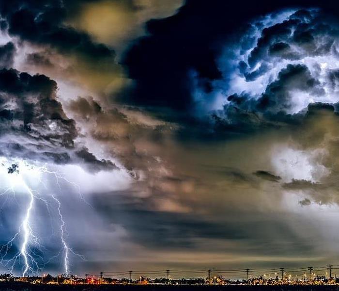
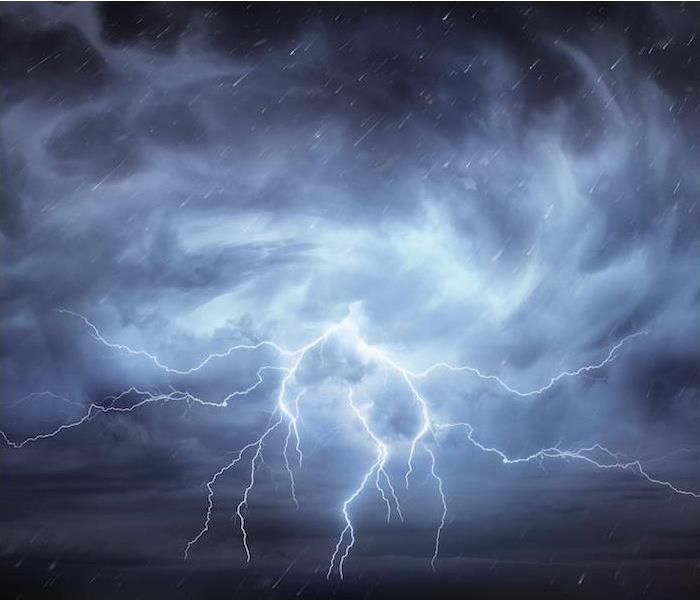
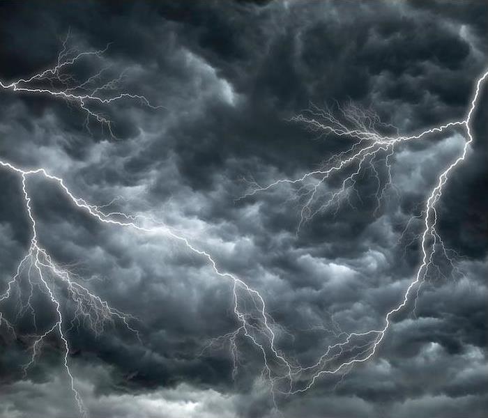
The Dangers of Lightning during a Storm
11/2/2022 (Permalink)
 Lightning can be very dangerous in a storm, call us if you need help.
There are many ways in which a thunderstorm can cause damage. Flooding or wind damage are what often come to mind, but it is also important to consider the risks associated with lightning when discussing thunderstorms.
While some storms bring rain and water, every storm is made up of electricity, creating the possibility for lightning even in the absence of precipitation. Lightning bolts can be up to 500,000 degrees, causing damage and even fatalities when they strike. An understanding of what lightning is and how it can be dangerous is extremely helpful in helping homeowners prevent these risks.
How Thunderstorms and Lightning Coexist
All thunderstorms contain the electricity that makes a lightning strike possible. What we know as a lightning strike is actually a rapid burst of electricity that occurs when this charge becomes agitated.
The atmosphere is not an ideal conductor, which is why lightning tends to strike objects—this creates a less resistant route in getting to the ground. When a home is the object that has been struck, lightning will usually forge this path through water pipes and wiring.
How Lightning Is Dangerous to Homes
While there are many dangers surrounding thunderstorms, there are three main ones involved with lightning striking a house:
The risk of fire. One of the biggest dangers of a lightning strike to a house is the fire hazard it causes. Lightning is hot enough to ignite building materials, causing a fire to break out at the point of impact. Additionally, lightning traveling through wires can cause them to fray, creating fire hazards all throughout the home.
The risk of power surges. Because of the electrical charge at play with lightning, it can easily transfer that to the wiring in the home. This is what we call a power surge, which can affect any electronic device plugged in that is not routed through a surge protector.
The risk of shock waves. Shock waves are typically manifested in thunder, but they can also occur at the site of a lightning strike. Shock waves have been known to crack chimneys, break windows and explode cinder blocks, making them extremely hazardous to a home’s structure.
If your home has been affected by storm damages or lightning-related fires, click here to contact us. We are experts in damage cleanup and can restore your damage quickly.
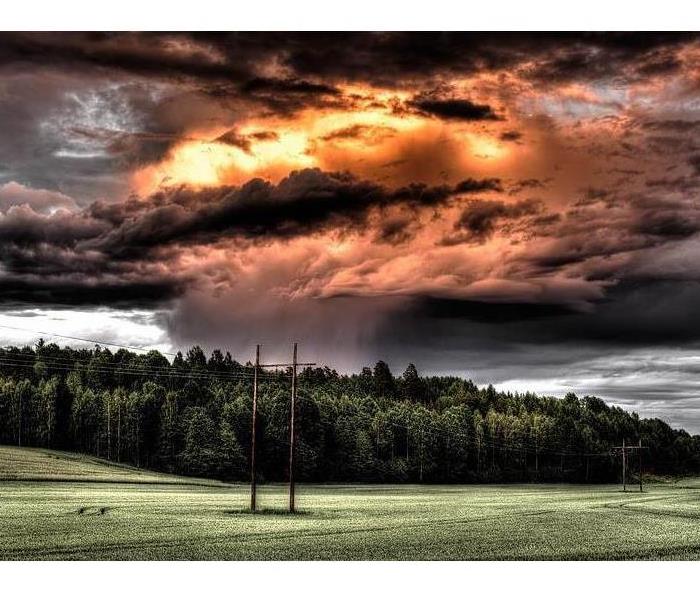
Storm Safety
8/1/2022 (Permalink)
 There are many damages that can come from a storm. Follow our safety tips to stay safe.
No matter where you live, you'll encounter storms. Most of the time these are routine, but some cause serious and dangerous problems. Here are tips for preparing for storms, and weathering them safely.
Always keep a battery-powered radio in your home so that you can tune to radio stations if you lose electricity. Check or change the batteries frequently.
Keep a flashlight in an easily accessible spot on every floor of your home. Check the batteries monthly, and replace them as needed.
Keep a supply of candles on hand for power failures.
As a safety precaution before leaving the house on vacation, unplug all electrical appliances except for those lights connected to automatic timers.
If you live in a storm-prone area, nail down roof shingles or use adequate adhesive to keep them from blowing off in a violent wind. For roofs with shingles that are not the seal-down type, apply a little dab of roofing cement under each tab.
A lightning-protection system should offer an easy, direct path for the bolt to follow into the ground and thus prevent injury or damage. Grounding rods (at least two for a house) should be placed at opposite corners of the house.
Don't go out during a hurricane unless you have to; however, if flooding threatens, seek high ground, and follow the instructions of civil defense personnel.
When a major storm is imminent, close shutters, board windows, or tape the inside of larger panes with an "X" along the full length of their diagonals. Even a light material like masking tape may give the glass the extra margin of strength it needs to resist cracking.
When a tornado threatens, leave windows slightly ajar.
The basement is not a good shelter during a tornado -- it's too close to gas pipes, sewer pipes, drains, and cesspools. A better shelter would be underground, far from the house (in case the roof falls) and away from the gas and sewer systems. Let all family members know where the shelter is.
Keep an eye on large trees -- even healthy ones -- that could damage your house if felled in a storm. Cut them back, if necessary.
We've covered numerous key tips for preparing for storms and getting through them safely. Now you can regard gathering clouds with a little less trepidation.
After a storm if you need assistance you can always reach out to us here in SERVPRO of Central Union County at 908-233-7070.
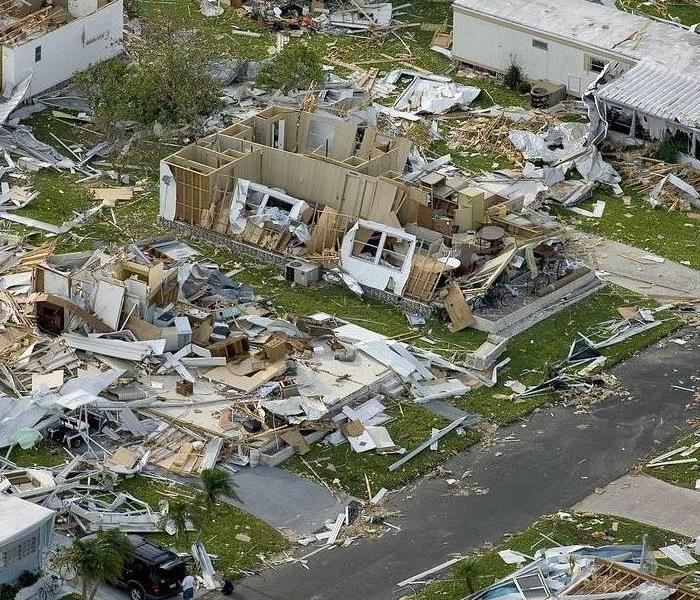
Prepare NOW For Storm Wind Damage
7/18/2022 (Permalink)
 Hurricanes can be devastating, prepare now to stay safe.
As we approach hurricane season, now is the time to begin to think about storm damage, even here in the northeast. Preparing your business or home now can help prevent unnecessary damages to your building when that storm hits.
Wind can come in the form of hurricanes, tornadoes, cyclones, microbursts, or downdrafts. It can be valuable to understand the impact of high winds and how to best protect your business, home, and property from wind damage. There are many ways to reinforce a building against wind damage — some are simple enough to DIY while others may require a pro.
First, inspect your building's roof, siding, windows and doors, and even landscaping to identify vulnerable spots. Replacing many of these items can be very expensive, so this may not be an option. However, being prepared to install temporary protection in the event of a storm that brings high winds and heavy rains may be all you need to do. No solution is perfect; mother nature knows that, but doing nothing to prepare is not the best option either.
Doors
When considering the role doors play in protecting buildings from high winds, it is customary to think about our exterior doors first. They are the doors that provide the first line of defense from high winds and blowing debris.
While wind-resistant doors and break-resistant glass play a significant role in fighting winds, interior doors are also essential. In hurricane winds or when a tornado may be imminent, all doors and windows, including every interior door, should be closed. This can prevent pressure build-up inside a building, leading to losing a room. Closing interior doors will also help compartmentalize damage from wind or rain if there is a breach in the exterior of a building.
Impact-resistant doors are the best possible solution, but if these are not installed, then:
- inspect doors for any cracks or missing or damaged hardware.
- Ensure no air leaks around the door and replace standard hinge screws with longer, stronger screws that will reach into the wall frame.
- Ensure the threshold seals the door bottom and is screwed deeply into the floor.
- Add a deadbolt to exterior doors that extend a minimum of one inch.
- If you have French-style double doors, make sure they are refitted with bolts that extend at least an inch into the floor.
- Finally, reinforce doors (and windows) with sheets of plywood when a hurricane approaches. This can be cost-effective and should be planned.
Windows
Many items in a yard can quickly turn into projectiles during high winds. These items make a building's windows vulnerable during high winds, especially when standard glass is used.
Even a small branch or piece of flying debris can start a landslide of damage once a window is cracked. As winds continue to put force on the broken window, the break can become more extensive and even cause the complete failure of the window. Winds and rain now have even greater access to the building's interior, creating further damage. Once winds enter a space, the entire structure, including the roof, is at risk.
There are only two options when it comes to providing better window protection. One is to cover or reinforce windows, and the other is to upgrade windows to high-impact glass.
Roofing
The roof is one of the most significant parts of a building. It is helpful to think of it as a combination of materials that protect your home from the elements and help keep warmth and cool air inside.
The roof is susceptible to damage in high winds for various reasons. As a roof ages, shingles can become brittle and lose adhesion to the structure. Older roofs aren't reinforced as well as more modern structures and are more easily damaged. While a roof is large and heavy, it can be no match for high winds as elements get peeled away, or the entire roof structure may even be lifted away. Of course, once the roof has been compromised, wind and water can enter the interior of the building, and the entire building will be at risk.
There is no additional protection you can provide for a roof except repairing damaged sections or replacing the roof entirely.
Garage Door
A garage door is typically the most significant moving part of an entire home. Generally speaking, garage doors are designed to move upward and downward. Under the stress of high winds, they can and do fail. This can cause a chain reaction of destruction and damage to a home once wind and moisture are introduced to the area.
Check to see that all seals around the door are good enough to prevent winds from entering. Protecting a garage door can be done with special braces or installing plywood as you would with windows.
Home Siding
Another area of a home that should be of concern in high winds is the siding. Like the roof, windows, and doors, keeping a home's siding inspected and properly maintained will go a long way in maintaining its integrity in a windstorm. Like those other areas, the key is preventing the wind from getting a foothold behind the siding, allowing it to tear it off of the structure.
Preparing the siding of a building is to repair damages sections and gaps where wind could enter or complete replacement of the system.
Landscaping and Outdoor Items
An important component of protecting a building in high winds is minimizing the potential projectiles that can become airborne. These projectiles can result from trees and limbs and from an assortment of yard items.
Depending on how much warning you have prior to a wind event, these items should be safely stored. Larger items which cannot be stored should be disassembled and stored, or at the very least turned upside down and secured to the ground. You should consider every item not secured in their outdoor spaces as a potential projectile.
Taking Shelter Indoors
The safest place in a building during a high wind event is generally the same; an interior room on the lowest level of a structure, away from windows and exterior doors. In some cases, this may be a basement or a first-floor interior closet or bathroom.
Be sure to take a battery operated radio or weather radio with you along with a flashlight. Blankets may offer additional protection and in severe cases, mattresses can be used to provide cover. If an interior bathroom is used, the tub can provide additional protection.
When disaster strikes your home or business, choose the #1 ranked in Restoration Services. Choose SERVPRO of Central Union County and Roselle.
Contact us at (908) 233-7070 if you have a service need or click here to visit our website to learn more about SERVPRO of Central Union County and Roselle's System Services.
Places To Find Cash After A Disaster
7/1/2022 (Permalink)
It happens when you least expect it, and you certainly don't plan for it. The natural disaster, like a flood, fire or any other type of personal catastrophe that leaves you in dire need of liquid funds.
Self preservation requires cash. If you’re hit with an emergency and need to find cash fast, of course, the first place to look are your bank accounts. If these funds are not sufficient, then look to these resources.
1. Family and Close Friends
If you need to find cash fast, ask your family and friends. If they can help, remember to always treat this as a loan and never treat it casually.
If you need to, attach an interest rate and a payment time frame, as you would any official loan from a financial institution. This is important because your family or friend have to charge you something for the transaction to be considered a loan and not a gift that could have tax and estate planning implications.
2. The Government
FEMA is able to provide disaster assistance for such needs as temporary housing, home repair, disaster-related medical expenses, vehicle damage and cleanup costs. Another source, the U.S. Small Business Administration (SBA) offers federally subsidized loans for renters, private nonprofit organizations and home and business owners.
Here's the catch...to qualify for either a FEMA or SBA loan, you must live in a federally declared disaster zone and file a claim with their insurance company first.
3. Life Insurance
Permanent life insurance policies are great resources because they’re readily accessible funds. The can be borrowed against without having to qualify for a loan, and you can pay a policy loan back on your own schedule.
However, rules will vary with insurance providers. Many require policyholders to own their policies for a few years before they can qualify to borrow. You’ll also be charged interest for taking out a policy loan.
4. CDs, Savings Bonds and Mutual Funds / Stocks
CD's: You can take your money out of a CD, but you’ll likely pay a penalty. Sacrificing some earnings is a relatively insignificant compared to paying interest rates on a life insurance loan.
Savings bonds: Savings bonds are another quick cash resource. You might need to pay a three-month interest penalty if a bond is redeemed too early though. In both cases, of course you’ll pay income tax on any interest earned.
Mutual Funds: You can sell stocks as well as mutual funds and annuities. If you take this route, consult your financial adviser about likely tax issues and penalties.
5. College 529 Savings
You may need to borrow from your future to pay present obligations. You 529 College Savings Account is a good resource for this. However, according to the Securities and Exchange Commission, those who withdraw funds out of a 529 plan for non-qualified education expenses will pay income tax and a 10 percent penalty on any earnings.
6. Retirement Accounts
Retirement accounts can be used to fund personal financial needs. It's important to understand the long term personal retirement planning impact. So plan accordingly and know the difference between a Roth IRA and a traditional IRA.
Roth IRA holders may withdraw their own contributions — not earnings — without tax or penalty.
Traditional IRA holders may start taking penalty-free distributions on their accounts if they begin taking regular distributions, but specific rules apply. You’ll pay income taxes and a 10 percent penalty on the taxable amount if you’re under age 59½.
7. A 401(k) Loan
A 401(k) loan is usually a better option than using a 529 or IRA loan.
401(k) holders can borrow up to half of their account balance, up to $50,000, tax-free, but, in most cases, funds must be repaid within five years.
The shortcoming is that you have to stay with your current employer for the duration of the loan period. If you leave your job, you’ll have 30 to 60 days to repay the loan or face penalties.
Before pulling funds from any long-term investment, read the fine print and always consult your tax adviser.
Contact us at (908) 233-7070 if you have a service need or click here to visit our website to learn more about SERVPRO of Central Union County's System Services.
Preparedness for Pest: After The Storm | SERVPRO of Central Union County | Roselle
4/19/2022 (Permalink)
 Please feel free to contact our office for all of your pet and property needs.
Have you accounted for Fido or Lucy when emergency planning?
After The Storm
After Hurricane Katrina, "It’s estimated that over 15,500 animals were ultimately rescued. Of the 15,500 animals rescued, only 15%-20% were ever reunited with their owners.”
Source: Louisiana Society for the Prevention of Cruelty to Animals, la-spca.org
Pets are just as important as any family member to most people, so why would you not make them a part of your preparedness planning? There are several things you can do to make sure they stay safe as well during an emergency.
Pet Emergency Kit
Ready.gov/pets lists the below items as essential to building your Pet Emergency Kit.
- Food. At least a three-day supply in an airtight, waterproof container.
- Water. At least three days of water specifically for your pets.
- Medicines and medical records.
- Important documents. Registration information, adoption papers, and vaccination documents. Talk to your veterinarian about microchipping and enrolling your pet in a recovery database.
- First aid kit. Cotton bandage rolls, bandage tape, and scissors; antibiotic ointment; flea and tick prevention; latex gloves, isopropyl alcohol, and saline solution. Including a pet first aid reference book is a good idea too.
- Collar or harness with ID tag, rabies tag and a leash.
- Crate or pet carrier. Have a sturdy, safe crate or carrier in case you need to evacuate. The carrier should be large enough for your pet to stand, turn around and lie down.
- Sanitation. Pet litter and litter box if appropriate, newspapers, paper towels, plastic trash bags and household chlorine bleach.
- A picture of you and your pet together. If you become separated, a picture of you and your pet together will help you document ownership and allow others to assist you. Add species, breed, age, sex, color, and distinguishing characteristics.
- Familiar items. Familiar items, such as treats, toys, and bedding can help reduce stress for your pet.
Evacuations
While practicing fire escape or evacuation plans, be sure to include pets. If an evacuation happens, don’t leave pets behind as they can be lost or injured.
Identification
Micro-chipping pets is a great way to locate them. Most veterinary clinics and shelters have scanners that will read the microchip information to help find a pet’s owners.
Be sure to take four-legged friends into consideration when planning for emergencies. Visit ready.gov/pets for further tips and safety precautions to think about for you or your insured’s families’ pets, or your tenant's pets’ during a disaster.
Please feel free to contact our office for all of your pet and property needs.
SERVPRO is Prepared for any Storm
11/24/2021 (Permalink)
 A quick response time with an alertful team will ensure that your restoration needs are professionally completed by us.
SERVPRO of Central Union County & SERVPRO of Roselle specializes in storm and flood damage restoration. Our crews are highly trained, and we use specialized equipment to restore your property to its pre-storm condition.
Faster Response
Since we are locally owned and operated, we are able to respond quicker with the right resources, which is extremely important. A fast response lessens the damage, limits further damage, and reduces the restoration cost.
Resources to Handle Floods and Storms
When storms hit Central Union County, we can scale our resources to handle a large storm or flooding disaster. We can access equipment and personnel from a network of 1,800 Franchises across the country and elite Disaster Recovery Teams that are strategically located throughout the United States.
Have Storm or Flood Damage? Call Us Today at (908) 233-7070
How to Prepare for Floods and Storm Damage
11/24/2021 (Permalink)
 A quick response time with an alertful team will ensure that your restoration needs are professionally completed by SERVPRO.
Unfortunately, the likelihood of floods is increasing across the U.S., even in areas that aren’t usually prone to excess water. But the fact remains that if rain is possible, so are floods.
A flood officially occurs when two or more acres, or two or more properties, have been partially or completely inundated with water.
But if you are facing a flood, the last thing you’ll be worried about is the official definition. You’ll be worried about your safety and the safety of your property.
This blog contains helpful flood preparation tips - not to worry, none of them suggest building an ark.
1. Back-Up PowerIn an emergency, you should have a generator. It’s impossible to know whether or not a storm or flooding will take out the power – and you don’t want to be left in the dark. The type of generator you need depends on a few different variables.
Don’t forget: water is a conduit for electricity, and after a flood you’ll be facing a lot of excess water. When you know that flooding is imminent, move all your appliances and electrical devices to safer ground.
2. Risk LevelBefore flooding is expected, you should become familiar with your property’s risk for floods. Local government and FEMA are good resources for this. A familiarity with flood zones, risk, and causes is the first step of preparation. For Westfield, NJ, and the surrounding areas, start here.
Another smart risk-management tool is a weather radio. Purchase a weather radio and learn how to use it, including what the different emergency notifications mean.
3. Emergency PrepIt’s important to have an emergency preparedness kit that can handle any emergency. But you should also have supplies tailor to specific severe weather events. Because floodwater contains contaminants, be sure to pack plenty of clean and fresh water. Choose a waterpoof case for your kit and all it contains, like important documents. For a more detailed list on what should be in your emergency kit, read this.
4. Evacuation PlanYour evacuation plan should include two things. One: become familiar with the local and federal government plans for evacuation. Second: create a personal evacuation plan and involve all members of the family. The plan should be practiced until everyone has it memorized. Be sure to include an emergency communication plan as part of the overall evacuation plan.
Many floods are caused by severe storms and excess rain. Remember that significant storm damage may be caused and may not be noticeable until after flood waters recede.
To get life back on track after flooding and storm damage, call SERVPRO® of Central Union County & Roselle.
Understanding the Basics of Damaging Winds | SERVPRO of Central Union County & Roselle
11/19/2021 (Permalink)
 If your home has been hit by damaging winds and resulting water damage, we are here to help with the cleanup and restoration of your home.
Damaging winds are one of the threats that comes with severe storms. These winds can catch you off guard and be problematic due to long-term structural impacts.
Why Damaging Winds Are Such a Major Concern
Tornadoes and hurricanes are not the only times damaging winds occur. Damaging winds are considered winds with wind speeds exceeding 50–60 mph and can be produced by a strong thunderstorm. Often, you will hear damaging winds referred to as “straight-line” winds to differentiate the damage from tornado damage.
The damage from straight-line winds can be especially destructive, often causing unanchored objects to become projectiles. Any windows or roof can take the brunt of this damage. If the damage is extensive, it can result in water damage to the home as outside elements come indoors through broken windows or damaged roofs.
Anyone who lives in a thunderstorm-prone area can be at risk from damaging winds, but there are some structures, such as mobile homes, especially at risk. Mobile homes, even those that are anchored, could sustain serious damage in winds gusting over 80 mph.
Ways to Prepare Your Home
There are a number of things you can do to protect your property from damaging winds, but there are two things to remember, keeping the “Two R’s” in mind: reinforce and remove.
Look into having your garage door reinforced by a professional.
Ensure that any loose objects on your property that could become wind-borne are properly stored or anchored. Remember that trash cans, grills and outdoor furniture are easily picked up by strong winds.
Larger, older decaying trees and branches should be professionally removed, which will ensure they cannot be blown onto your home.
Remember, high winds can occur without advanced notice. By taking some, or all, of the above actions, you can be prepared on a moment’s notice.
Also, if you are building a new home or renovating an older home, be sure windows, walls and doors are up to code for your area.
If your home has been hit by damaging winds and resulting water damage, the highly trained specialists at SERVPRO® of Central Union County & SERVPRO® of Roselle & are here to help with the cleanup and restoration of your home.
Prepare For Floods and Storm Damage
8/2/2021 (Permalink)
 To get life back on track after flooding and storm damage, call SERVPRO® of Central Union County & Roselle.
Unfortunately, the likelihood of floods is increasing across the U.S., even in areas that aren’t usually prone to excess water. But the fact remains that if rain is possible, so are floods.
A flood officially occurs when two or more acres, or two or more properties, have been partially or completely inundated with water.
But if you are facing a flood, the last thing you’ll be worried about is the official definition. You’ll be worried about your safety and the safety of your property.
This blog contains helpful flood preparation tips - not to worry, none of them suggest building an ark.
- Back-Up Power In an emergency, you should have a generator. It’s impossible to know whether or not a storm or flooding will take out the power – and you don’t want to be left in the dark. The type of generator you need depends on a few different variables.
Don’t forget: water is a conduit for electricity, and after a flood you’ll be facing a lot of excess water. When you know that flooding is imminent, move all your appliances and electrical devices to safer ground.
- Risk Level Before flooding is expected, you should become familiar with your property’s risk for floods. Local government and FEMA are good resources for this. A familiarity with flood zones, risk, and causes is the first step of preparation. For Westfield, NJ, and the surrounding areas, start here.
Another smart risk-management tool is a weather radio. Purchase a weather radio and learn how to use it, including what the different emergency notifications mean.
- Emergency Prep It’s important to have an emergency preparedness kit that can handle any emergency. But you should also have supplies tailor to specific severe weather events. Because floodwater contains contaminants, be sure to pack plenty of clean and fresh water. Choose a waterproof case for your kit and all it contains, like important documents. For a more detailed list on what should be in your emergency kit, read this.
- Evacuation Plan Your evacuation plan should include two things. One: become familiar with the local and federal government plans for evacuation. Second: create a personal evacuation plan and involve all members of the family. The plan should be practiced until everyone has it memorized. Be sure to include an emergency communication plan as part of the overall evacuation plan.
Many floods are caused by severe storms and excess rain. Remember that significant storm damage may be caused and may not be noticeable until after flood waters recede.
Making Sure Your Family is Prepared for Severe Weather | SERVPRO® of Central Union & Roselle
7/20/2021 (Permalink)
 Having a team on your side after a disaster can help relieve stress. SERVPRO® of Central Union County is here to help 24/7.
Today, we are fortunate to have advance warning for some types of severe weather, but there are also times where Mother Nature manages to catch us by surprise.
Fortunately, there are steps you can take and safety tips to follow that will guide you in preparing for your family’s safety in various severe weather occurrences.
Where to Start
One of the best ways to ensure your family’s safety is to have an established family emergency plan at the ready.
Be sure to go over your plan together as a family at the beginning of each weather season if there is an emergency plan in place so everyone knows exactly what to do.
Here are some things to take into consideration when creating your family emergency plan if you have not yet done so:
1. How will emergency alerts and warnings be received?
Thanks to technology today, emergency alerts and warnings are at our fingertips with our smartphones that are equipped with a weather app or Google. We can quickly receive emergency alerts, that provide us with valuable time in severe weather situations. Warnings and alerts are also still broadcast over radio and TV.
2. What type of storm shelter do you have?
Where tornadoes are a common occurrence, you’ll want to be in the lowest part of your home, preferably a basement, or if there is no basement, use an interior room on the lowest level that is away from corners, windows, doors and outside walls. Tornadoes aren’t the only weather circumstance that require a form of storm shelter, and you can learn about more of the situations that call for them by visiting ready.gov.
3. What are the evacuation routes?
Have you mapped out multiple evacuation routes because hurricanes, flooding and fires can force you from your home at a moment’s notice. It’s wise to have multiple routes in the event one is impassable, and be sure you find places to stay with your pets along the way if you have furry family members involved in your evacuation.
4. How will everyone stay in touch?
Cell phones are the easiest way to keep in touch with your family, but in some circumstances, that just will not be possible. Cell phone towers can be damaged and phones could be lost or left behind; not to mention batteries will not last forever and there will be no power to recharge them.
Your family should have an emergency communication plan in place as well as a safe meeting place so that you can all meet there if separated.
If a storm does cause damage to your home or business, don’t hesitate to call your friends at SERVPRO® of Central Union County to get the cleanup and restoration process started.
It’s Time to Prepare for Spring Storms | SERVPRO® of Central Union County & Roselle
4/20/2021 (Permalink)
 Storm and lighting damage require specialized restoration techniques and equipment. When a storm hits your home, you need us.
Spring is here! That means that, even though we are enjoying warmer weather, we also must now prepare for whatever Mother Nature may choose to send our way.
Spring = Thunderstorms
With the arrival of spring comes longer days and more sunshine, but it also brings the threat of severe weather throughout the country. It’s a toss-up this time of year, meaning the weather may change at moment’s notice.
Unstable temperatures are the cause of the changing weather, with temps that can go from warm to cold even in the same day. That temperature change can result in extreme weather changes as well.
Thunderstorms become more common during the spring and are the main cause of severe weather. A thunderstorm will occur whenever warm, moist air collides with cool, dry air, a common occurrence in the spring and summer.
In taking a look at natural catastrophe losses in the U.S. for 2017, severe thunderstorms were the most common and produced some of the costliest results. Out of 50 events, there were 85 fatalities and an estimated total of $25.4 billion in overall losses.
With these storms comes the threat of flooding, high winds and even tornadoes if the conditions are right. It has been found that in modern history, 10% of all violent tornadoes have occurred in March, with April, May and June taking the top spots at 30%, 24% and 15% respectively.
Make Sure Your Family Is Prepared
Weather forecasters are not able to predict the weather with 100% accuracy, but fortunately, they do have the technology available to at least give us an idea of severe weather that could be coming. Advanced warnings, along with the right preparation, can greatly improve overall safety for your family.
Here are some things you can do to your home to prepare for the chance of severe weather:
- Clear out your home’s gutters, drains and downspouts.
- Trim trees of precarious limbs or branches that could break off in a storm.
- Secure or store outdoor belongings if severe weather is in the forecast.
Having an emergency kit on hand is always advised. These kits should include the following:
- Battery-operated flashlight and NOAA weather radio, with extra batteries for both
- Emergency evacuation or shelter plans
- Important personal info, like telephone numbers of neighbors, family and friends, insurance and property info, numbers for the utility companies, and medical info
- A first-aid kit with things like non-latex gloves, adhesive bandages, tweezers, sterile gauze pads, aspirin packets, adhesive cloth tape and scissors
- 3–5 day supply of bottled water and nonperishable food
- Personal hygiene items
- Blankets or sleeping bag
Despite its unpredictability, there is one thing that always remains true of the spring weather season: It always happens. If your home or business is damaged in a storm, you can depend on SERVPRO® of Central Union County to get the cleanup and restoration process started fast.
Understanding Thunderstorm Damage | SERVPRO of Central Union County | SERVPRO of Roselle
11/25/2020 (Permalink)
 If a thunderstorm has resulted in damage to your home or business, know our team is available 24/7 to help with cleanup and restoration.
Thunderstorms are a regular occurrence during the warmer spring and summer seasons, bringing along the risk of damage to your property.
Thunderstorms come in varying levels of intensity. Do you know what those are?
Understanding Thunderstorms
Across the world, an average of 16 million thunderstorms occur each year. The U.S. can see upward of 100,000 thunderstorms annually, with an estimated 10% earning severe status.
Thunderstorms need certain conditions to be met in order to form. Moisture and rising unstable air are required, along with a “lifting” mechanism, which could be things like hills or mountains that force air to rise, or where warm/cold or wet/dry air bump together, causing that rising motion.
There are three stages in a thunderstorm’s life cycle. Those are the developing stage, the mature stage and the dissipating stage. It is during the mature stage that things like hail, strong rain, lightning, high winds and tornadoes are most likely to occur.
Common Types of Damage
Thunderstorms can prove dangerous in many different ways, but an extremely serious threat stems from the possibility of seeing flying debris due to high winds.
During severe storms, wind can see speeds in excess of 57.5 mph, and that is certainly high enough to result in damage to your property.
Even the most unexpected items could reach projectile status during a high wind situation. A smart thing to do is make sure you have scouted your yard for items that could turn dangerous, such as tree branches, lawn furniture, and fencing, and then taken steps to secure them before a storm comes into town.
Besides wind damage, thunderstorms can also produce these types of damage:
Lightning damage. Not only can lightning strikes cause a fire, they can also wreak havoc on your electrical systems. Since a lightning strike can pass through the wiring of your home, it can lead to the damage of anything plugged in.
Tornado damage. With wind speeds that can reach as high as 200 mph, tornadoes are especially destructive. They are able to cover a large area and do their damage in a limited amount of time.
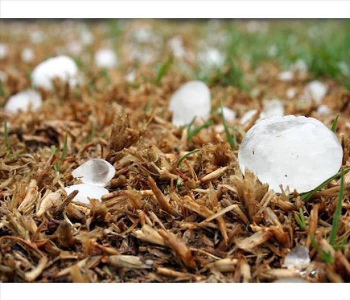
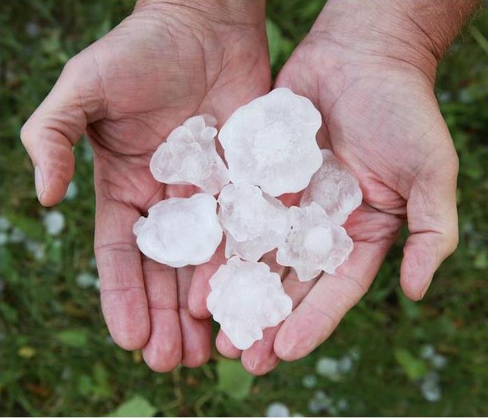
Hail damage. Believe it or not, hail damage can top out around $1 billion a year. Small hail can damage crops throughout the country, while larger hail can damage vehicles, roofing and windows.
Flood damage. Rain almost always accompanies a storm, so it should not come as a surprise that heavy rains can turn into flood danger. Flash flooding can have the strength to rip trees out of the ground and sweep items and structures away.
Storm Damage: What are the Causes? SERVPRO of Central Union County | SERVPRO of Roselle
11/24/2020 (Permalink)
 When disaster strikes, we strike back!
In the past few months, New Jersey has been experiencing a high level of heavy rainfall. Did you know heavy rainfall and subsequent flooding is one of the common types of damage from storms? There are ten common types of storms and being familiar with them aids in storm preparation and damage prevention.
We know how important it is to homeowners to keep homes safe from storm damage.
The 5 most common storms are:- Hurricanes
- Tornadoes
- Thunderstorms
- Snow storm
- Hail storms
Since Union County is so far north and so close to the coast, it’s very possible that you may experience each of these kinds of events.
The fact is that hurricanes cause damage far past the coast. That storms cause damage is obvious, but the kinds of damage they cause and how is not always known.
Since hurricanes have long-term effects (Hurricane Sandy impacted 24 states), it’s very important to be educated on that type of storm in particular.
Hurricane damage is caused by three distinct but related storm elements: storm surge, floods, and wind.Storm surge is when water rises far past the predicted tide level. This rise occurs because the wind from the hurricane pushes the water toward the shore, giving it nowhere to go, except up and in. The force of storm surge can be so strong as to destroy buildings and roads.
Storm surge is a direct cause of floods. The extra water from storm surge can reach far inland, causing widespread floods as it goes. Hurricanes can also cause rainfall as far as 100 miles past where the hurricane actually hits. Even tropical storms that don’t reach hurricane level can cause excess rainfall and thus floods.
Wind from hurricanes can reach speeds of 74 mph up to 155 mph. Winds of this speed cause widespread destruction by uprooting trees, downing power lines, and carrying debris and tossing it against other structures, even causing roofs to lift. It’s not unheard of for hurricane winds to form tornadoes.
Storm surge, floods, and winds can cause damage that is far-reaching, unexpected, and overwhelming. You can take precautions by packing an emergency preparedness kit, installing weather-resistant features to your house, and always following official safety orders or directives.
Making Sure Your Family Is Prepared for Severe Weather | SERVPRO of Central Union County | SERVPRO of Roselle
11/17/2020 (Permalink)
 Having a team on your side after a disaster can help relieve stress. SERVPRO of Central Union County & SERVPRO of Roselle is here to help 24/7.
Today, we are fortunate to have advance warning for some types of severe weather, but there are also times where Mother Nature manages to catch us by surprise.
Fortunately, there are steps you can take and safety tips to follow that will guide you in preparing for your family’s safety in various severe weather occurrences.
Where to Start
One of the best ways to ensure your family’s safety is to have an established family emergency plan at the ready.
Be sure to go over your plan together as a family at the beginning of each weather season if there is an emergency plan in place so everyone knows exactly what to do.
Here are some things to take into consideration when creating your family emergency plan if you have not yet done so:
1. How will emergency alerts and warnings be received?
Thanks to technology today, emergency alerts and warnings are at our fingertips with our smartphones that are equipped with a weather app or Google. We can quickly receive emergency alerts, that provide us with valuable time in severe weather situations. Warnings and alerts are also still broadcast over radio and TV.
2. What type of storm shelter do you have?
Where tornadoes are a common occurrence, you’ll want to be in the lowest part of your home, preferably a basement, or if there is no basement, use an interior room on the lowest level that is away from corners, windows, doors and outside walls. Tornadoes aren’t the only weather circumstance that require a form of storm shelter, and you can learn about more of the situations that call for them by visiting ready.gov.
3. What are the evacuation routes?
Have you mapped out multiple evacuation routes because hurricanes, flooding and fires can force you from your home at a moment’s notice. It’s wise to have multiple routes in the event one is impassable, and be sure you find places to stay with your pets along the way if you have furry family members involved in your evacuation.
4. How will everyone stay in touch?
Cell phones are the easiest way to keep in touch with your family, but in some circumstances, that just will not be possible. Cell phone towers can be damaged and phones could be lost or left behind; not to mention batteries will not last forever and there will be no power to recharge them.
Your family should have an emergency communication plan in place as well as a safe meeting place so that you can all meet there if separated.
If a storm does cause damage to your home or business, don’t hesitate to call your friends at SERVPRO® of Central Union County to get the cleanup and restoration process started.
The Dangers of Lightning During Storms | SERVPRO of Central Union County | SERVPRO of Roselle
11/11/2020 (Permalink)
 Storm & lightning damage require specialized restoration techniques and equipment. When a storm hits your home, you need the company with experience.
There are many ways in which a thunderstorm can cause damage. Flooding or wind damage are what often come to mind, but it is also important to consider the risks associated with lightning when discussing thunderstorms.
While some storms bring rain and water, every storm is made up of electricity, creating the possibility for lightning even in the absence of precipitation. Lightning bolts can be up to 500,000 degrees, causing damage and even fatalities when they strike. An understanding of what lightning is and how it can be dangerous is extremely helpful in helping homeowners prevent these risks.
How Thunderstorms and Lightning Coexist
All thunderstorms contain the electricity that makes a lightning strike possible. What we know as a lightning strike is actually a rapid burst of electricity that occurs when this charge becomes agitated.
The atmosphere is not an ideal conductor, which is why lightning tends to strike objects—this creates a less resistant route in getting to the ground. When a home is the object that has been struck, lightning will usually forge this path through water pipes and wiring.
How Lightning Is Dangerous to Homes
While there are many dangers surrounding thunderstorms, there are [three main ones involved with lightning striking a house]:
The risk of fire. One of the biggest dangers of a lightning strike to a house is the fire hazard it causes. Lightning is hot enough to ignite building materials, causing a fire to break out at the point of impact. Additionally, lightning traveling through wires can cause them to fray, creating fire hazards all throughout the home.
The risk of power surges. Because of the electrical charge at play with lightning, it can easily transfer that to the wiring in the home. This is what we call a power surge, which can affect any electronic device plugged in that is not routed through a surge protector.
The risk of shock waves. Shock waves are typically manifested in thunder, but they can also occur at the site of a lightning strike. Shock waves have been known to crack chimneys, break windows and explode cinder blocks, making them extremely hazardous to a home’s structure.
If your home has been affected by storm damages or lightning-related fires, give us a call today! We are experts in damage cleanup and can restore your damage quickly.
Understanding the Basics of Damaging Winds | SERVPRO of Central Union County & SERVPRO of Roselle
11/9/2020 (Permalink)
 We are available for cleanup and restoration services 24 hours a day, seven days a week.
Damaging winds are one of the threats that comes with severe storms. These winds can catch you off guard and be problematic due to long-term structural impacts.
Why Damaging Winds Are Such a Major Concern
Tornadoes and hurricanes are not the only times damaging winds occur. Damaging winds are considered winds with wind speeds exceeding 50–60 mph and can be produced by a strong thunderstorm. Often, you will hear damaging winds referred to as “straight-line” winds to differentiate the damage from tornado damage.
The damage from straight-line winds can be especially destructive, often causing unanchored objects to become projectiles. Any windows or roof can take the brunt of this damage. If the damage is extensive, it can result in water damage to the home as outside elements come indoors through broken windows or damaged roofs.
Anyone who lives in a thunderstorm-prone area can be at risk from damaging winds, but there are some structures, such as mobile homes, especially at risk. Mobile homes, even those that are anchored, could sustain serious damage in winds gusting over 80 mph.
Ways to Prepare Your Home
There are a number of things you can do to protect your property from damaging winds, but there are two things to remember, keeping the “Two R’s” in mind: reinforce and remove.
Look into having your garage door reinforced by a professional.
Ensure that any loose objects on your property that could become wind-borne are properly stored or anchored. Remember that trash cans, grills and outdoor furniture are easily picked up by strong winds.
Larger, older decaying trees and branches should be professionally removed, which will ensure they cannot be blown onto your home.
Remember, high winds can occur without advanced notice. By taking some, or all, of the above actions, you can be prepared on a moment’s notice.
Also, if you are building a new home or renovating an older home, be sure windows, walls and doors are up to code for your area.
If your home has been hit by damaging winds and resulting water damage, the highly trained specialists at SERVPRO® of Central Union County & SERVPRO of Roselle are here to help with the cleanup and restoration of your home.
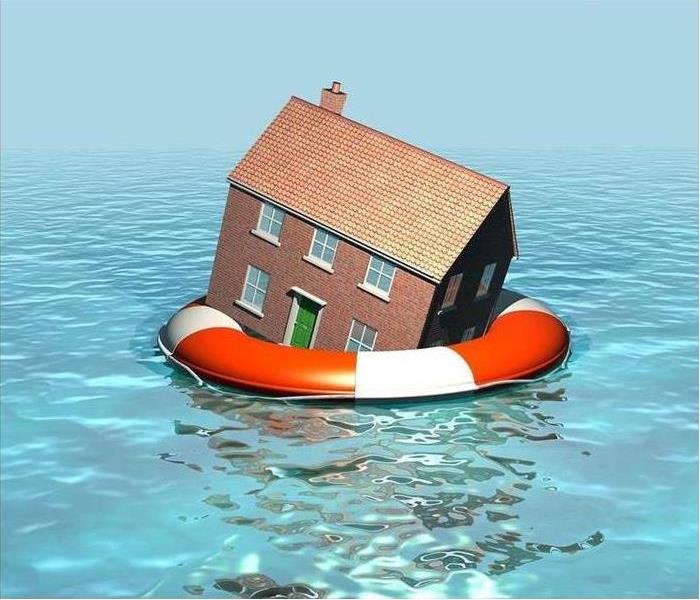
How Homeowners Can Protect Their Homes Against Flood Damage | SERVPRO® of Central Union County | Western Essex County
8/1/2020 (Permalink)
 We are available for cleanup and restoration services 24 hours a day, seven days a week.
Did you know that out of all natural disasters, 90% involve some form of flooding? While no one wants to think about the dangers a flood could pose, it is important that homeowners understand their risks.
Though your home may not have a history of flooding in the past, it is still essential to be aware of the risks a flood could pose should it occur.
How to Reduce Damage From a Flood
Here are some ways for flood damage to be prevented for your home:
Stay aware of the risks. Using the FEMA Flood Map Tool or contacting your local authorities in emergency management, you can understand what specific measures you should take to stay aware.
Elevate valuables. Irreplaceable paperwork and documents such as family memorabilia, tax returns and other important files would be better kept in a secondary location, such as a safety deposit box.
Turn off electricity. It may be unlikely that electrical appliances or outlets would be affected by water, but it is still dangerous to have these things be live anywhere near floodwaters. Shut off the electrical breaker to any rooms that are at-risk for a flood.
Anchor propane and fuel tanks. A dangerous spill or even a fire can result from fuel tanks tipping or propane tanks leaking. Remove fuel tanks from the property or anchor them securely.
Discuss emergency procedures. Ensure every member of the household is aware of what to do should the need to evacuate arise. Keep emergency supplies on-hand, and make sure all adults know where to shut off the home’s utilities.
Raise hazardous materials. Elevate things such as oil, paint and cleaning supplies to prevent dangerous spills into the floodwater.
Prepare appliances. In the case of a shallow flood, appliances such as washers and dryers can be elevated on bricks or stands to protect the internal workings from water damage.
A disaster, such as a flood, puts into perspective that the most important thing is keeping your family safe. By understanding precautionary measures and disaster action plans, homeowners can protect their family and their home from flood dangers.
If you’ve experienced water damage due to a flood or other causes, SERVPRO® of Central Union County | Western Essex County is here to help. Our technicians are fully trained in water remediation, and our 24⁄7 Emergency Line means we’ll be there for you when you call, 908.650.8611.
The Dangers of Lightning During Storms | SERVPRO® of Central Union County | SERVPRO® of Western Essex County
4/14/2020 (Permalink)
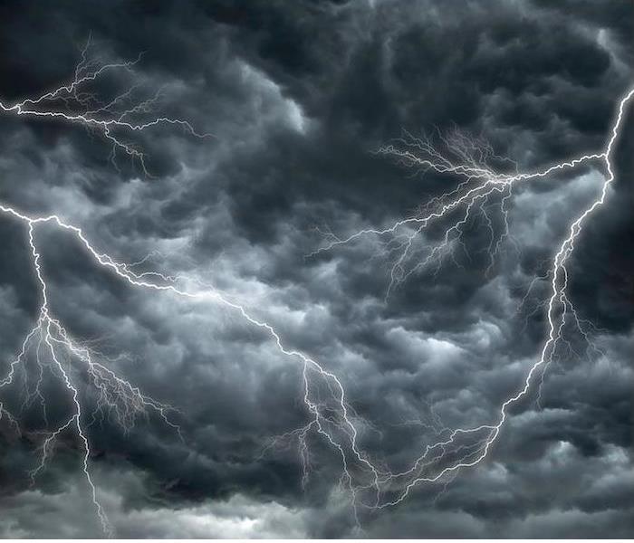 We are available for emergency cleanup and restoration services 24 hours a day, seven days a week.
There are many ways in which a thunderstorm can cause damage. Flooding or wind damage are what often come to mind, but it is also important to consider the risks associated with lightning when discussing thunderstorms.
While some storms bring rain and water, every storm is made up of electricity, creating the possibility for lightning even in the absence of precipitation. Lightning bolts can be up to 500,000 degrees, causing damage and even fatalities when they strike. An understanding of what lightning is and how it can be dangerous is extremely helpful in helping homeowners prevent these risks.
How Thunderstorms and Lightning Coexist
All thunderstorms contain the electricity that makes a lightning strike possible. What we know as a lightning strike is actually a rapid burst of electricity that occurs when this charge becomes agitated.
The atmosphere is not an ideal conductor, which is why lightning tends to strike objects—this creates a less resistant route in getting to the ground. When a home is the object that has been struck, lightning will usually forge this path through water pipes and wiring.
How Lightning Is Dangerous to Homes
While there are many dangers surrounding thunderstorms, there are three main ones involved with lightning striking a house:
The risk of fire. One of the biggest dangers of a lightning strike to a house is the fire hazard it causes. Lightning is hot enough to ignite building materials, causing a fire to break out at the point of impact. Additionally, lightning traveling through wires can cause them to fray, creating fire hazards all throughout the home.
The risk of power surges. Because of the electrical charge at play with lightning, it can easily transfer that to the wiring in the home. This is what we call a power surge, which can affect any electronic device plugged in that is not routed through a surge protector.
The risk of shock waves. Shock waves are typically manifested in thunder, but they can also occur at the site of a lightning strike. Shock waves have been known to crack chimneys, break windows and explode cinder blocks, making them extremely hazardous to a home’s structure.
If your home has been affected by storm damages or lightning-related fires, click here to contact us. We are experts in damage cleanup and can restore your damage quickly.
Tornado Safety Tips Your Family Can Use | SERVPRO® of Central Union County & SERVPRO® of Western Essex County
11/25/2019 (Permalink)
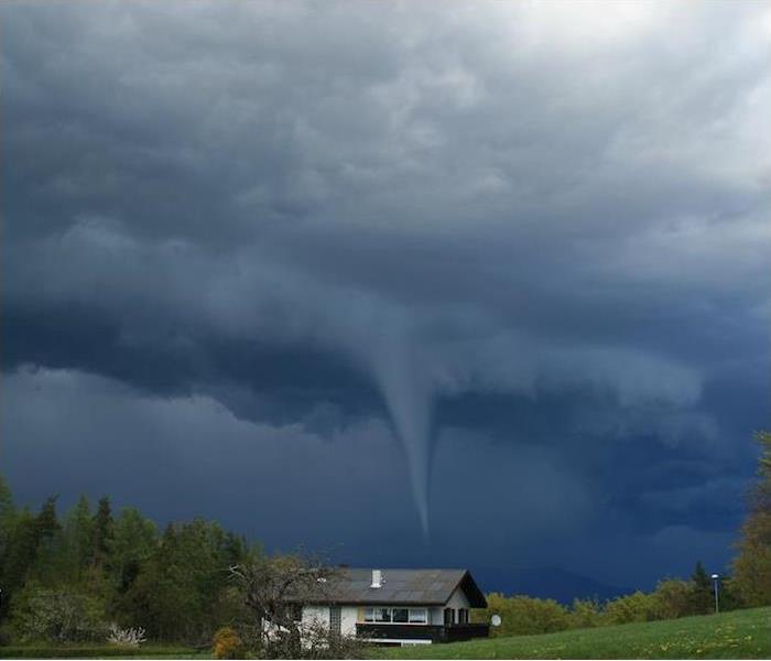 If your home or business has been damaged by a tornado, know that we are ready to jump into action and get cleanup & restoration underway.
Springtime weather can be unpredictable and create the perfect conditions for a tornado. You should always be prepared for the chance of severe thunderstorms that contribute to tornadoes.
In April and May, we traditionally have the highest occurrences of tornadoes at 30% and 24% respectively, which means we are currently in the height of tornado season throughout the United States.
Included in this blog are some tips and information on tornadoes that can help keep your family prepared for the worst possible scenario.
Each year, roughly 1,200 tornadoes occur in the U.S., and they develop from thunderstorms, especially those known as “supercells.”
When changes in wind speed and direction create a horizontal spinning effect within a storm cell, a tornado forms. This is then tipped vertical by rising air moving up through the thunderclouds.
When a tornado first develops, the signature funnel cloud is transparent, but it will become visible when water droplets from the storm’s moist air condense or when dust and debris are picked up. A typical tornado can grow to be 660 feet wide and will move at 10 to 20 miles per hour, although larger and faster have been observed. Hail and intense winds of over 200 mph can accompany tornadoes.
Tornadoes usually occur during spring and summer late in the afternoon, but please remember that they can occur anytime and anywhere.
<h4you-should-do-during-a-tornado-warning">What You Should Do During a Tornado Warning
Educate yourself about the differences between tornado watches and tornado warnings. A watch is issued if conditions are favorable for tornadoes, while a warning is issued when a tornado has been reported by spotters or indicated by radar.
If you are in the path of a “warned” tornado, it is vital to take immediate action and find a safe shelter.
Shelter options include:
- Underground options like a basement or storm shelter.
- The lowest part of your home, in an area that is away from outside walls, doors and windows. Interior closets and bathrooms can be ideal options.
- If you are outside, try to get to a sturdy building. Mobile homes and trailers are not a safe option.
- If on the road and no building access is available, do not get under an overpass or bridge. Instead, find a low, flat location and use your arms to protect your head and neck.
Make sure that you have flashlights, a battery-powered weather radio and extra batteries readily available in your selected tornado shelter at home. Also, when you are taking shelter in your home, you can provide additional cover by using furniture items like couch cushions, mattresses or blankets to help in keeping your head and neck covered.
When caught out on the road during a tornado, DO NOT try to outrun it!
Tornadoes can wreak absolute havoc on the areas where they touch down. While meteorologists and weather services can provide some advanced warning to potential threats, tornadoes can still occur with little to no warning at all.
If your home or business has been damaged by a tornado, know that SERVPRO® of Central Union County & SERVPRO® of Western Essex County is ready and waiting to jump into action and get cleanup and restoration of your property underway.
Understanding the Basics of Damaging Winds | SERVPRO® of Central Union County & SERVPRO® of Western Essex County
11/25/2019 (Permalink)
 If your home has been hit by damaging winds and resulting water damage, our highly trained specialists are here to help.
Damaging winds are one of the threats that comes with severe storms. These winds can catch you off guard and be problematic due to long-term structural impacts.
Why Damaging Winds Are Such a Major ConcernTornadoes and hurricanes are not the only times damaging winds occur. Damaging winds are considered winds with wind speeds exceeding 50–60 mph and can be produced by a strong thunderstorm. Often, you will hear damaging winds referred to as “straight-line” winds to differentiate the damage from tornado damage.
The damage from straight-line winds can be especially destructive, often causing unanchored objects to become projectiles. Any windows or roof can take the brunt of this damage. If the damage is extensive, it can result in water damage to the home as outside elements come indoors through broken windows or damaged roofs.
Anyone who lives in a thunderstorm-prone area can be at risk from damaging winds, but there are some structures, such as mobile homes, especially at risk. Mobile homes, even those that are anchored, could sustain serious damage in winds gusting over 80 mph.
Ways to Prepare Your HomeThere are a number of things you can do to protect your property from damaging winds, but there are two things to remember, keeping the “Two R’s” in mind: reinforce and remove.
Look into having your garage door reinforced by a professional.
Ensure that any loose objects on your property that could become wind-borne are properly stored or anchored. Remember that trash cans, grills and outdoor furniture are easily picked up by strong winds.
Larger, older decaying trees and branches should be professionally removed, which will ensure they cannot be blown onto your home.
Remember, high winds can occur without advanced notice. By taking some, or all, of the above actions, you can be prepared on a moment’s notice.
Also, if you are building a new home or renovating an older home, be sure windows, walls and doors are up to code for your area.
If your home has been hit by damaging winds and resulting water damage, the highly trained specialists at SERVPRO® of Central Union County & SERVPRO® of Western Essex County & are here to help with the cleanup and restoration of your home.
The Dangers of Lightning During Storms | SERVPRO® of Central Union County
11/18/2019 (Permalink)
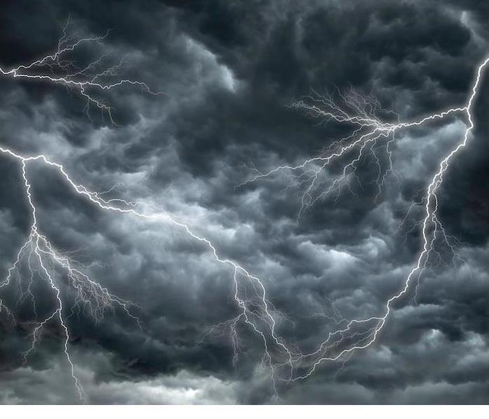 Having a team on your side after a disaster can help relieve stress. SERVPRO of Central Union County is here to help.
There are many ways in which a thunderstorm can cause damage. Flooding or wind damage are what often come to mind, but it is also important to consider the risks associated with lightning when discussing thunderstorms.
While some storms bring rain and water, every storm is made up of electricity, creating the possibility for lightning even in the absence of precipitation. Lightning bolts can be up to 500,000 degrees, causing damage and even fatalities when they strike. An understanding of what lightning is and how it can be dangerous is extremely helpful in helping homeowners prevent these risks.
How Thunderstorms and Lightning CoexistAll thunderstorms contain the electricity that makes a lightning strike possible. What we know as a lightning strike is actually a rapid burst of electricity that occurs when this charge becomes agitated.
The atmosphere is not an ideal conductor, which is why lightning tends to strike objects—this creates a less resistant route in getting to the ground. When a home is the object that has been struck, lightning will usually forge this path through water pipes and wiring.
How Lightning Is Dangerous to HomesWhile there are many dangers surrounding thunderstorms, there are [three main ones involved with lightning striking a house]:
The risk of fire. One of the biggest dangers of a lightning strike to a house is the fire hazard it causes. Lightning is hot enough to ignite building materials, causing a fire to break out at the point of impact. Additionally, lightning traveling through wires can cause them to fray, creating fire hazards all throughout the home.
The risk of power surges. Because of the electrical charge at play with lightning, it can easily transfer that to the wiring in the home. This is what we call a power surge, which can affect any electronic device plugged in that is not routed through a surge protector.
The risk of shock waves. Shock waves are typically manifested in thunder, but they can also occur at the site of a lightning strike. Shock waves have been known to crack chimneys, break windows and explode cinder blocks, making them extremely hazardous to a home’s structure.
If your home has been affected by storm damages or lightning-related fires, give us a call today!We are experts in damage cleanup and can restore your damage quickly.
Understanding Thunderstorm Damage | SERVPRO® of Central Union County
11/18/2019 (Permalink)
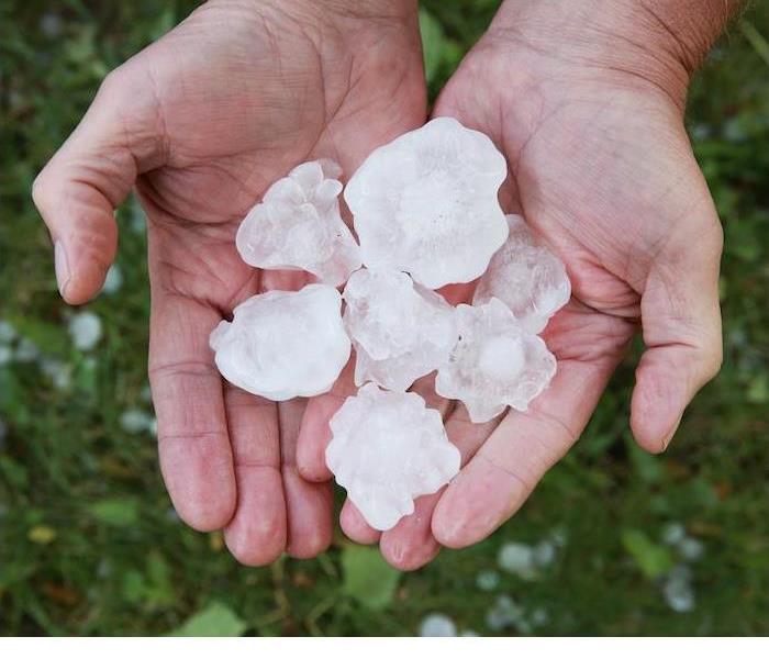 If a thunderstorm has resulted in damage to your home or business, know that the team at SERVPRO® of Central Union County is available 24/7.
Thunderstorms are a regular occurrence during the warmer spring and summer seasons, bringing along the risk of damage to your property.
Thunderstorms come in varying levels of intensity. Do you know what those are?
Understanding Thunderstorms
Across the world, an average of 16 million thunderstorms occur each year. The U.S. can see upward of 100,000 thunderstorms annually, with an estimated 10% earning severe status.
Thunderstorms need certain conditions to be met in order to form. Moisture and rising unstable air are required, along with a “lifting” mechanism, which could be things like hills or mountains that force air to rise, or where warm/cold or wet/dry air bump together, causing that rising motion.
There are three stages in a thunderstorm’s life cycle. Those are the developing stage, the mature stage and the dissipating stage. It is during the mature stage that things like hail, strong rain, lightning, high winds and tornadoes are most likely to occur.
Common Types of Damage
Thunderstorms can prove dangerous in many different ways, but an extremely serious threat stems from the possibility of seeing flying debris due to high winds.
During severe storms, wind can see speeds in excess of 57.5 mph, and that is certainly high enough to result in damage to your property.
Even the most unexpected items could reach projectile status during a high wind situation. A smart thing to do is make sure you have scouted your yard for items that could turn dangerous, such as tree branches, lawn furniture, and fencing, and then taken steps to secure them before a storm comes into town.
Besides wind damage, thunderstorms can also produce these types of damage:
Lightning damage. Not only can lightning strikes cause a fire, they can also wreak havoc on your electrical systems. Since a lightning strike can pass through the wiring of your home, it can lead to the damage of anything plugged in.
Tornado damage. With wind speeds that can reach as high as 200 mph, tornadoes are especially destructive. They are able to cover a large area and do their damage in a limited amount of time.
Hail damage. Believe it or not, hail damage can top out around $1 billion a year. Small hail can damage crops throughout the country, while larger hail can damage vehicles, roofing and windows.
Flood damage. Rain almost always accompanies a storm, so it should not come as a surprise that heavy rains can turn into flood danger. Flash flooding can have the strength to rip trees out of the ground and sweep items and structures away.
If a thunderstorm has resulted in damage to your home or business, know that the team at SERVPRO® of Central Union County is available 24⁄7 to help with cleanup and restoration.
Storm Safety - New Jesery
8/1/2019 (Permalink)
What a heat wave we have been experiencing lately in the northeast. I think everyone here in Jersey can agree that it finally feels like summer! We have been experiencing hot sunny weekends in the 90s, impromptu trips to the beach, and endless barbeques. But with hot weather comes brutal showers.
Severe thunderstorms pummeled across New Jersey and the Northeast these last few days, causing flooding on major roads, widespread ongoing power outages, fallen trees and utility lines, damage to homes and even fatality. SERVPRO of Central Union County would like to stress the severity and the potential threat storms can cause.
To keep from putting yourself at risk, we encourage our community to please stay away from storm-damaged areas, downed power lines that can potentially have live wires, and to never drive through a flooded road. During storms, use a battery-operated radio to get updates from local officials. Stay away from windows and doors. Make an emergency supply kit. We recommend having water, non-perishable food, flashlights and extra batteries, clothing and hygiene items, important documents, and cash.
As Always, SERVPRO of Central Union County are here to handle any water damages, no matter the home or business. Give us a call at 908-233-7070 to set up a free inspection with us. We are here to serve our community!
It’s Time to Prepare for Spring Storms
4/16/2019 (Permalink)
Spring is here! That means that, even though we are enjoying warmer weather, we also must now prepare for whatever Mother Nature may choose to send our way.
Spring = ThunderstormsWith the arrival of spring comes longer days and more sunshine, but it also brings the threat of severe weather throughout the country. It’s a toss-up this time of year, meaning the weather may change at moment’s notice.
Unstable temperatures are the cause of the changing weather, with temps that can go from warm to cold even in the same day. That temperature change can result in extreme weather changes as well.
Thunderstorms become more common during the spring and are the main cause of severe weather. A thunderstorm will occur whenever warm, moist air collides with cool, dry air, a common occurrence in the spring and summer.
In taking a look at natural catastrophe losses in the U.S. for 2017, severe thunderstorms were the most common and produced some of the costliest results. Out of 50 events, there were 85 fatalities and an estimated total of $25.4 billion in overall losses.
With these storms comes the threat of flooding, high winds and even tornadoes if the conditions are right. It has been found that in modern history, 10% of all violent tornadoes have occurred in March, with April, May and June taking the top spots at 30%, 24% and 15% respectively.
Make Sure Your Family Is PreparedWeather forecasters are not able to predict the weather with 100% accuracy, but fortunately, they do have the technology available to at least give us an idea of severe weather that could be coming. Advanced warnings, along with the right preparation, can greatly improve overall safety for your family.
Here are some things you can do to your home to prepare for the chance of severe weather:
- Clear out your home’s gutters, drains and downspouts.
- Trim trees of precarious limbs or branches that could break off in a storm.
- Secure or store outdoor belongings if severe weather is in the forecast.
Having an emergency kit on hand is always advised. These kits should include the following:
- Battery-operated flashlight and NOAA weather radio, with extra batteries for both
- Emergency evacuation or shelter plans
- Important personal info, like telephone numbers of neighbors, family and friends, insurance and property info, numbers for the utility companies, and medical info
- A first-aid kit with things like non-latex gloves, adhesive bandages, tweezers, sterile gauze pads, aspirin packets, adhesive cloth tape and scissors
- 3–5 day supply of bottled water and nonperishable food
- Personal hygiene items
- Blankets or sleeping bag
Despite its unpredictability, there is one thing that always remains true of the spring weather season: It always happens. If your home or business is damaged in a storm, you can depend on SERVPRO® of Central Union County to get the cleanup and restoration process started fast.
PREPARE FOR FLOODS AND STORM DAMAGE
10/4/2018 (Permalink)
Unfortunately, the likelihood of floods is increasing across the U.S., even in areas that aren’t usually prone to excess water. But the fact remains that if rain is possible, so are floods.
A flood officially occurs when two or more acres, or two or more properties, have been partially or completely inundated with water.
But if you are facing a flood, the last thing you’ll be worried about is the official definition. You’ll be worried about your safety and the safety of your property.
This blog contains helpful flood preparation tips - not to worry, none of them suggest building an ark.
- Back-Up Power In an emergency, you should have a generator. It’s impossible to know whether or not a storm or flooding will take out the power – and you don’t want to be left in the dark. The type of generator you need depends on a few different variables.
Don’t forget: water is a conduit for electricity, and after a flood you’ll be facing a lot of excess water. When you know that flooding is imminent, move all your appliances and electrical devices to safer ground.
- Risk Level Before flooding is expected, you should become familiar with your property’s risk for floods. Local government and FEMA are good resources for this. A familiarity with flood zones, risk, and causes is the first step of preparation. For Westfield, NJ, and the surrounding areas, start here.
Another smart risk-management tool is a weather radio. Purchase a weather radio and learn how to use it, including what the different emergency notifications mean.
- Emergency Prep It’s important to have an emergency preparedness kit that can handle any emergency. But you should also have supplies tailor to specific severe weather events. Because floodwater contains contaminants, be sure to pack plenty of clean and fresh water. Choose a waterproof case for your kit and all it contains, like important documents. For a more detailed list on what should be in your emergency kit, read this.
- Evacuation Plan Your evacuation plan should include two things. One: become familiar with the local and federal government plans for evacuation. Second: create a personal evacuation plan and involve all members of the family. The plan should be practiced until everyone has it memorized. Be sure to include an emergency communication plan as part of the overall evacuation plan.
Many floods are caused by severe storms and excess rain. Remember that significant storm damage may be caused and may not be noticeable until after flood waters recede.
To get life back on track after flooding and storm damage, call SERVPRO® of Central Union County.
Preparedness for Pets: After the Storm
10/1/2018 (Permalink)
Pets are just as important as any family member to most people, so why would you not make them a part of your preparedness planning? There are several things you can do to make sure they stay safe as well during an emergency. Pet Emergency Kit Ready.gov/animals lists the below items as essential to building your Pet Emergency Kit.
- Food: At least a three-day supply in an airtight, waterproof container.
- Water: At least three days of water specifically for your pets.
- Medicines and medical records.
- Important documents: Registration information, adoption papers and vaccination documents. Talk to your veterinarian about microchipping and enrolling your pet in a recovery database.
- First aid kit: Cotton bandage rolls, bandage tape and scissors; antibiotic ointment; flea and tick prevention; latex gloves, isopropyl alcohol and saline solution. Including a pet first aid reference book is a good idea too.
7.Collar or harness with ID tag, rabies tag and a leash.
8.Crate or pet carrier: Have a sturdy, safe crate or carrier in case you need to evacuate. The carrier should be large enough for your pet to stand, turn around and lie down.
- Sanitation: Pet litter and litter box if appropriate, newspapers, paper towels, plastic trash bags and household chlorine bleach.
- A picture of you and your pet together: If you become separated, a picture of you and your pet together will help you document ownership and allow others to assist you. Add species, breed, age, sex, color and distinguishing characteristics. Familiar items. Familiar items, such as treats, toys and bedding can help reduce stress for your pet.
Evacuations While practicing fire escape or evacuation plans, be sure to include pets. If an evacuation happens, don’t leave pets behind as they can be lost or injured.
Identification Microchipping pets is a great way to locate them. Most veterinary clinics and shelters have scanners that will read the microchip information to help find a pet’s owners. Be sure to take four-legged friends into consideration when planning for emergencies. Visit ready.gov/ animals for further tips and safety precautions to think about for you or your insured’s families’ pets, or your tenants pets’ during a disaster.
Storm Damage: What are the Causes?
9/27/2018 (Permalink)
In the past few months, New Jersey has been experiencing a high level of heavy rainfall. Did you know heavy rainfall and subsequent flooding is one of the common types of damage from storms? There are ten common types of storms and being familiar with them aids in storm preparation and damage prevention.
SERVPRO® of Central Union County knows how important it is to homeowners to keep homes safe from storm damage.
The 5 most common storms are:
- Hurricanes
- Tornadoes
- Thunderstorms
- Snow storm
- Hail storms
Since Union County is so far north and so close to the coast, it’s very possible that you may experience each of these kinds of events.
The fact is that hurricanes cause damage far past the coast. That storms cause damage is obvious, but the kinds of damage they cause and how is not always known.
Since hurricanes have long-term effects (Hurricane Sandy impacted 24 states), it’s very important to be educated on that type of storm in particular.
Hurricane damage is caused by three distinct but related storm elements: storm surge, floods, and wind.
Storm surge is when water rises far past the predicted tide level. This rise occurs because the wind from the hurricane pushes the water toward the shore, giving it nowhere to go, except up and in. The force of storm surge can be so strong as to destroy buildings and roads.
Storm surge is a direct cause of floods. The extra water from storm surge can reach far inland, causing widespread floods as it goes. Hurricanes can also cause rainfall as far as 100 miles past where the hurricane actually hits. Even tropical storms that don’t reach hurricane level can cause excess rainfall and thus floods.
Wind from hurricanes can reach speeds of 74 mph up to 155 mph. Winds of this speed cause widespread destruction by uprooting trees, downing power lines, and carrying debris and tossing it against other structures, even causing roofs to lift. It’s not unheard of for hurricane winds to form tornadoes.
Storm surge, floods, and winds can cause damage that is far-reaching, unexpected, and overwhelming. You can take precautions by packing an emergency preparedness kit, installing weather-resistant features to your house, and always following official safety orders or directives.
Storm damage clean up can be exhausting and dangerous. Don’t do it alone. Call SERVPRO® of Central Union County for expert storm damage restoration services.
SERVPRO Is Ready For Any Storm
8/30/2018 (Permalink)
SERVPRO of Central Union County specializes in storm and flood damage restoration. Our crews are highly trained, and we use specialized equipment to restore your property to its pre-storm condition.
Faster Response
Since we are locally owned and operated, we are able to respond quicker with the right resources, which is extremely important. A fast response lessens the damage, limits further damage, and reduces the restoration cost.
Resources to Handle Floods and Storms
When storms hit Central Union County, we can scale our resources to handle a large storm or flooding disaster. We can access equipment and personnel from a network of 1,650 Franchises across the country and elite Disaster Recovery Teams that are strategically located throughout the United States.
Have Storm or Flood Damage? Call Us Today at (908) 233-7070
How to Handle Storm Damage
8/28/2018 (Permalink)
When storm damage hits Central Union County homes and businesses, it's important to know what to do until SERVPRO crews get on site.
- Call SERVPRO of Central Union County at (908) 233-7070 immediately upon discovering damage.
- Shut off the source of water (ie: replace sump pump) or contact a qualified party to stop the water source.
- Remove as much excess water as possible by mopping and blotting. Use a shop vac or carpet cleaning machine to suck water from carpets. Do Not use a household vacuum cleaner.
- Place aluminum foil or wood blocks between furniture legs and wet carpeting.
- Remove electronics, documents, sensitive or valuable items to a dry place.
- Use wooden clothespins to keep furniture skirting and window curtains off damp floors.
- Pull carpet back from the walls to limit water wicking into the drywall.
Don't forget that when storm damage strikes, SERVPRO of Central Union County is here to help.
Get Ready For The Thunderstorm
4/16/2018 (Permalink)
SERVPRO of Central Union County cares gratefully about the safety of our customers. Thunderstorms can be a scary and overwhelming event. Here are some safety precautions that can be taken to insure your well-being.
- Keep yourself updated with news reports by listening to your local weather radios.
- When inside, stay off corded phones, computers, and other electronic equipment that put you in direct contact with electricity or plumbing.
- Unplug any appliances or electrical items such as TVs, computers, and air conditioners. If you are not able to unplug, turn it off.
- Secure any doors and shutters. Make sure that you remove any dead or rotting branches from trees that could potentially fall and cause damage to your home or anyone.
Remember, Storm damage is likely to occur depending on the intensity of the storm. For any services you may need whether an emergency or a quote, please feel free to give us a call at (908) 233-7070
Source: http://www.jacksontwp.com
Storm Safety
10/25/2017 (Permalink)
No matter where you live, you'll encounter storms. Most of the time these are routine, but some cause serious and dangerous problems. Here are tips for preparing for storms, and weathering them safely.
- Always keep a battery-powered radio in your home so that you can tune to radio stations if you lose electricity. Check or change the batteries frequently.
- Keep a flashlight in an easily accessible spot on every floor of your home. Check the batteries monthly, and replace them as needed.
- Keep a supply of candles on hand for power failures.
- As a safety precaution before leaving the house on vacation, unplug all electrical appliances except for those lights connected to automatic timers.
- If you live in a storm-prone area, nail down roof shingles or use adequate adhesive to keep them from blowing off in a violent wind. For roofs with shingles that are not the seal-down type, apply a little dab of roofing cement under each tab.
- A lightning-protection system should offer an easy, direct path for the bolt to follow into the ground and thus prevent injury or damage. Grounding rods (at least two for a house) should be placed at opposite corners of the house.
- Don't go out during a hurricane unless you have to; however, if flooding threatens, seek high ground, and follow the instructions of civil defense personnel.
- When a major storm is imminent, close shutters, board windows, or tape the inside of larger panes with an "X" along the full length of their diagonals. Even a light material like masking tape may give the glass the extra margin of strength it needs to resist cracking.
- When a tornado threatens, leave windows slightly ajar.
- The basement is not a good shelter during a tornado -- it's too close to gas pipes, sewer pipes, drains, and cesspools. A better shelter would be underground, far from the house (in case the roof falls) and away from the gas and sewer systems. Let all family members know where the shelter is.
- Keep an eye on large trees -- even healthy ones -- that could damage your house if felled in a storm. Cut them back, if necessary.
We've covered numerous key tips for preparing for storms and getting through them safely. Now you can regard gathering clouds with a little less trepidation.
After a storm if you need assistance you can always reach out to us here in SERVPRO of Central Union County at 908-233-7070.
Hurricane Maria Aftermath
10/5/2017 (Permalink)
SAN JUAN, Puerto Rico — Two weeks after Hurricane Maria toppled Puerto Rico's communications towers, wrecked its electrical grid and knocked out power to water systems, medical officials said the island's health system is "on life support."
"We have hospitals that are working, but eventually we are going to have to transfer patients," said Carlos Méndez, an associate administrator at the Auxilio Mutuo Hospital in Hato Rey, one of the island’s top medical facilities.
Among the multiple impacts that have left the island’s medical system deeply damaged:
-Patients are dying because of complications related to the primitive conditions and difficult transportation issues so many island residents now endure.
-A lack of transportation in small towns makes it difficult to transfer patients to larger hospitals.
-An administrator in a small-town hospital has to drive her car to an ambulance company a mile away to ask for a patient to be transferred to a larger hospital.
-Severe lack of communications on the island has resulted in less triage and coordination between hospitals, and more patients arriving at large medical centers than usual, which has stretched capacity.
-Doctors are afraid to discharge patients after surgery to places with unsanitary conditions and where care and transportation may not exist, adding strain to an already strained system.
On Wednesday, health officials in Puerto Rico toured the 1,000-bed U.S. Naval Hospital Ship Comfort as it docked in San Juan, the capital. It is the largest floating medical facility in the U.S. military and the ship will be used to help deal with the medical crisis facing this island of 3.4 million residents.
Méndez, whose hospital has Puerto Rico's only fully functioning ward for cardio-thoracic surgery — for treatments inside the chest — said the U.S.S. Comfort’s arrival comes as the island's health system "right now is on life support."
Getting water, needing an ambulance
Across the island in the hill town of Adjuntas, near Puerto Rico’s southern coast, doctors and nurses at the Adjuntas medical center celebrated Wednesday the first shipment of water since Hurricane Maria blasted the town.
But the celebrations were cut short when Gladys Galarza, a nurse, brought a patient's electrocardiogram (EKG) chart to emergency room physician, Jorge Gagos.
The chart showed an abnormal rhythm.
The patient, an elderly woman with a history of heart trouble who was complaining of chest pains, needed a better-equipped hospital — and an ambulance to get there.
"We have a sick person and no ambulance," Gagos said. "Normally we have a phone to call. The nearest ambulance is one mile away."
Lacking a radio or a satellite phone, Gagos asked a hospital administrator to get in her car and deliver the message to the ambulance company, a private contractor. That led to an argument over payment. Eventually, after more than an hour, the ambulance showed up and took the woman to San Lucan Hospital in Ponce.
As he prepared to tour the Comfort, Carlos Gomez Marcial, emergency medical director at Centro Medico de Puerto Rico, the island’s top-level trauma center, listed the top challenges facing patients and hospitals: Water, food, communications.
"We can’t communicate with anybody," Gomez Marcial said. "Less than 10% of communications towers are standing. For command and control, it’s very hard to get things done without communications."
As a result, administrators cannot plan for receiving new patients. And without communications, the process that usually results in triaging patients based on how sick they are, and available beds in trauma hospitals, doesn’t work.
Centro Medico de Puerto Rico operated on generator power for three days after the storm, and contended with water shortages. It was finally connected to the grid on Saturday and is now nearing capacity.
After touring the floating hospital, Gomez Marcial said he would confer with other hospital officials on which patients to transfer.
"When they arrive by helicopter there’s no way to turn them away," added Juan Angel Nazario Fernandez, Centro Medico de Puerto Rico's senior medical officer.
Outside, in a series of tents set up in the hospital's parking lot, a low-level treatment center run by the U.S. Department of Homeland Security’s Disaster Medical Assistance Team (DMAT) is attempting to relieve some of that pressure.
“Our mission here is to decompress the emergency room,” said Lesa Ansell of Dallas, Tex., DMAT’s chief nursing officer here, and part of one of 18 teams across the island.
“We triage patients, treat some here, and send trauma and surgery patients inside."
Bad conditions, sicker patients
Orlando López de Victoria, the only cardio-thoracic surgeon still on the island, said more patients have arrived sicker than usual because of the difficult conditions.
Some have died.
On Monday, he operated on a patient whose transfer to Auxilio Mutuo in Hato Rey was delayed because there was no gasoline. By the time she arrived, her heart was so weak she didn't survive the operation.
On Tuesday, Gov. Ricardo Rosselló raised the death toll from Hurricane Maria from 16 to 34, citing several similar cases as part of the reason for the increase.
"Yesterday, one of my patients came with a very infected wound because he has no water to take a shower," López de Victoria said.
Other cardiac surgeons left the island before the hurricane.
"I decided to stay because I love my country, my family and my patients," he said.
For more information, or if you need help with flooding, or any water damage give us a call here at SERVPRO of Central Union NJ 908-233-7070
Tropical Storm Nate is On His Way
10/5/2017 (Permalink)
A newly formed tropical storm in the southwestern Caribbean is forecast to strengthen into a hurricane that could affect the U.S. Gulf Coast.
The system, formerly a tropical depression, strengthened into a tropical storm near the coast of Nicaragua this morning. Tropical Storm Nate was moving across northeastern Nicaragua, churning 50 miles northwest of Puerto Cabezas, as of 2 p.m. ET, according to the National Hurricane Center.
The tropical storm is pounding Nicaragua with rain heavy enough to cause life-threatening flash floods and mudslides. Up to 30 inches of rain is possible in some areas of Central America through Friday night.
Amid busy hurricane season, National Weather Service hampered by shortage of meteorologists
The rest of the 2017 hurricane season will be 'active' with more storms to come, NOAA meteorologist says
Tropical Storm Nate is expected to be near Cancun, Mexico, by Friday night, according to the National Hurricane Center.
A hurricane watch has already been issued for Mexico's Yucatan Peninsula, including Cancun.
Nate could reach hurricane status as early as Saturday while entering the Gulf of Mexico. Its trajectory has it on track to make landfall somewhere between New Orleans, Louisiana, and Mobile, Alabama, on Saturday night or Sunday morning as a weak Category 1 hurricane, with winds of about 80 mph. Then, the storm is expected to weaken to a post-tropical system, according to the National Hurricane Center.
But the track and the storm's strength are subject to change.
Residents from Louisiana to Florida are being warned to monitor the system as it approaches this weekend. The area is still feeling the effects of hurricanes Harvey and Irma.
So far, the Atlantic has seen five major hurricanes (Category 3 or higher) during the 2017 season; two short of the record set in 2005, when seven major hurricanes hit.
If you need any information on storm safety, flooding, and water damage precautions do give us a call here in SERVPRO of Central Union NJ at 908-233-7070
Hurricane Irma is on the Way
9/5/2017 (Permalink)
Meteorologists have been shocked at how rapidly Hurricane Irma has been strengthening, and they are already warning that if it hits the United States as a high-level category 5 storm the devastation would be absolutely unprecedented. Of course, we are already dealing with the aftermath of Hurricane Harvey, and many experts are already telling us that the economic damage done by that storm will easily surpass any other disaster in all of U.S. history. But there is a very real possibility that Hurricane Irma could be even worse. According to the National Hurricane Center, at 5 PM on Friday Irma already had sustained winds of 130 miles per hour. But it is still very early, and as you will see below, next week it is expected to potentially develop into a category 5 storm with winds of 180 miles per hour or more.
I suppose that it is appropriate that such a powerful storm has a very powerful name. In old German, the name “Irma” actually means “war goddess”…
The name Irma is a German baby name. In German the meaning of the name Irma is: Universal, from the Old German ‘irmin’. War goddess.
Irma began forming on Wednesday, and it intensified at a faster rate than any storm that we have seen in nearly 20 years…
Hurricane Irma formed early Wednesday in the warm waters off the coast of West Africa — and took just 30 hours to strengthen to a Category 3. That’s the fastest intensification rate in almost two decades. By Friday afternoon, the storm had also grown noticeably larger in size with a well-defined eye, a classic sign of a strong hurricane.
Though Irma poses no immediate threat to land, the outlook is ominous: In the Atlantic, Irma is expected to pass through some abnormally warm waters — the primary fuel source for storm systems. The official National Hurricane Center forecast says it will remain at major hurricane status for at least the next five days, and, in a worst-case scenario, Irma could eventually grow into one of the strongest hurricanes ever seen in the Atlantic.
So how powerful could Irma eventually become?
According to Michael Ventrice of the Weather Channel, Irma could easily become a “super typhoon” with “sustained speeds of over 180mph”…
Veteran USA forecaster Michael Ventrice posted the track model on Twitter overnight and warned it looked like the storm could be a “super typhoon”, with sustained speeds of over 180mph.
He wrote: “These are the highest windspeed forecasts I’ve ever seen in my 10 yrs of Atlantic hurricane forecasting.
“Irma is another retiree candidate.”
The scale we have right now really never envisioned storms that powerful. In fact, some have suggested that we need to add a “category 6” to describe the kind of “super storms” that are now developing in the Atlantic.
One of the reasons why Irma is so unique is because it is a “Cape Verde hurricane”…
There are a few factors that worry hurricane forecasters more about this storm when compared to the myriad other tropical storms and hurricanes that tend to form in the Atlantic.
First, it’s a so-called Cape Verde storm, having formed off the west coast of Africa. These storms tend to be the ones that go on to affect the U.S., after gathering strength for many days during their march across the ocean. For example, Hurricane Andrew, which was the most recent Category 5 storm to hit the U.S. in 1992, was a Cape Verde-type storm.
Because they begin at a relatively low latitude and move west rather than northwest, it can be harder for upper level winds blowing across North America to pick up and steer these types of storms away from the U.S. coast.
Let us hope that this storm does get steered away from our coastlines at some point, but so far that is just not happening.
Many hurricanes are often weakened by wind shear, but that isn’t happening to Irma either. In fact, CNN is reporting that “Irma will remain in a low-shear environment for the next several days”…
A strong high-pressure ridge to the north of Irma, over the Atlantic, is steering the storm to the west and limiting the wind shear in the upper levels of the atmosphere, which has allowed the storm to grow so quickly. Wind shear is like hurricane kryptonite, and prevents storms from forming or gaining strength.
Unfortunately, Irma will remain in a low-shear environment for the next several days, so there isn’t much hope that Irma will weaken any time soon.
Basically, conditions are nearly ideal for a “super storm” to develop, and if Irma does make it to the U.S. the destruction that it causes could be absolutely off the charts.
Of course, at this point, there is no guarantee that it will ever reach the United States. But if it does, and if it is still a category 5 storm when it arrives, we could be facing an event unlike anything that we have ever seen before.
Do you remember Hurricane Katrina? Well, scientists now know that when it hit New Orleans it had already been downgraded to just a “low category 3” storm…
To put this all in perspective, Katrina was a Category 5 hurricane out over some hot spots in the Gulf. But when it hit New Orleans, scientists now know, Katrina had winds at a low Category 3, and much of them Category 2, including the “left side winds” that then came down from the north and pushed the surge-swollen waters of Lake Pontchartrain over and through NOLA’s levees. (Hurricanes spin counterclockwise in the northern hemisphere, so when Katrina came ashore just east of New Orleans, its winds hit the city from the north.)
Only three Category 5s have come ashore in the United States in the past century — the 1935 Labor Day Hurricane, Camille in 1969 and Andrew in 1992.
And Hurricane Harvey was just a category 4 storm.
If Hurricane Irma were to make landfall as a category 5 storm with sustained winds of 180 miles per hour, it would rip buildings and everything else in its path to shreds.
Next week we shall find out what happens. Let us hope for the best, but let us also get prepared for the worst.
Article posted with permission from The Economic Collapse Blog
Take a look at the future of America: The Beginning of the End and then prepare
Hurricane Harvey: The Devastation and What Comes Next
8/31/2017 (Permalink)
Overwhelmed by the news since Harvey made landfall? Here is an overview of coverage by The New York Times.
The latest can be found in Thursday’s live storm briefing.
A region eyes recovery
With rainfall topping 47 inches in some areas, Harvey devastated aswath of Texas stretching east from Houston. “Our whole city is underwater,” Derrick Freeman, the mayor of Port Arthur, Texas, said on Wednesday.
A Times reporter shared his account of returning home to nearby Beaumont.
But even as the rain and wind moved on, the region continued to suffer the consequences of the storm. Explosions rocked a chemical plant early Thursday, and many hazards still lurk beneath the floodwaters that soaked the region.
As the sun returned on Wednesday, residents emerged to assess the damage.
Here are some of the most powerful photos of the devastation and a before-and-after look at the storm’s impact.
If you can do so safely, please share your own photos and videos here, or leave us a voice mail message. And listen to Thursday’s episode of “The Daily” to learn about how Houston was built to flood.
A look at the human toll
At least 38 people have died so far, including a Houston police officer, a family whose van was trapped beneath surging floodwater, and a mother whose shivering 3-year-old was found clinging to her unresponsive body.
The survivors face hurdles of their own and aid may be slow in coming. The difficulty of distributing aid was on display this week as many supply trucks arrived at a hub near San Antonio, but few went out.
Tens of thousands of people filled overcrowded shelters, the management of which remains “the biggest battle that we have right now,” Brock Long, the administrator of the Federal Emergency Management Agency, said on Thursday.
Vice President Mike Penceand other cabinet officials were expected to meet with storm survivors around Corpus Christi on Thursday, two days after President Trump himself visited the area.
Here’s a look at how victims sought out help online.
What made Harvey so powerful?
What set Harvey apart was its rain. Once it made landfall, the storm essentially stalled, turning roads into raging rivers. Scientists say it was fueled by a deadly combination of environmental factors.
And while it has been called a “500-year flood,” that term may be misleading: a similar storm may not be as far off as you might think.
For many people, the images of inundated streets and victims on rooftops evoked comparisons to Hurricane Katrina. In New Orleans, survivors of Katrina saw themselves in the scenes from Houston.
These maps track Harvey’s path through Texas and Louisiana. And here’s how experts prepared for the storm and worked to warn the public.
How to help
Many organizations are helping victims on the ground. Here are a few of them; a fuller list can be found here.
• The Hurricane Harvey Relief Fund was established by Mayor Sylvester Turner of Houston and is administered by the Greater Houston Community Foundation.
• The Houston Food Bank, the Galveston County Food Bank and the Food Bank of Corpus Christi are accepting online donations.
• The Houston Humane Society and the San Antonio Humane Society are helping animals affected by the storm.
• Save the Children is accepting donations.
Some scams are circulating online. Here are a few things to watch out for.
Exploding Chemical Plant
8/31/2017 (Permalink)
As water began to recede in some parts of flood-ravaged Houston and as Harvey, now a tropical depression, shifted its wrath to the Beaumont-Port Arthur area of Texas, there were reports early Thursday that a chemical plant at risk of exploding had done just that.
There were two explosions at the Arkema plant in Crosby, about 30 miles northeast of downtown Houston, around 2 a.m., the French chemicals company that owns the plant said in a statement.
It said there was a risk of further explosions at the site.
“We want local residents to be aware that the product is stored in multiple locations on the site, and a threat of additional explosion remains,” Arkema said.
CBS19, the Houston affiliate, reported the two explosions at the plant and showed photos of black smoke. The blasts were also reported by Fox 26.
The company had already ordered all workers to leave the damaged plant, and Harris County ordered the evacuation of residents within a 1.5-mile radius. After the explosion, at least one Harris County deputy was taken to the hospital after inhaling fumes from the plant, the Harris County Sheriff’s Office said on Twitter.
Later, the sheriff’s office tweeted that company officials believed that the smoke inhaled by the 10 deputies was “a nontoxic irritant.”
Richard Rowe, the chief executive of Arkema’s North American division, told Reuters that the company had expected the chemicals to catch fire.
The Arkema plant manufactures organic peroxides, which are used in making plastic and other materials. When the chemicals warm, they start to decompose, which creates more heat and can quickly lead to a rapid, explosive reaction. Some organic peroxides also produce flammable vapors as they decompose.
The plant was shut down last Friday in anticipation of the storm, and a skeleton crew of 11 was left behind to ensure that the chemicals, which are kept in cold storage, remained safe.
But Arkema said the plant had been without power since Sunday, and the torrential rains and flooding had damaged backup generators. With the storage warehouse warming up, the crew transferred the chemicals to diesel-powered refrigerated trailers, but some of those stopped working as well.
Here is the latest:
• The storm was downgraded to a tropical depression on Wednesday night. It is expected move through central Louisiana on Wednesday night, then move through northeastern Louisiana and northwestern Mississippi on Thursday.
• Vice President Mike Pence is expected to visit four locations around Corpus Christi, Tex., on Thursday, to meet with storm survivors, according to a senior administration official who spoke on condition of anonymity because the details of the trip were still being worked out.
• Officials have reported at least 38 deaths that were related or suspected to be related to the storm. The victims include a police officer who died on his way to work; a mother who was swept into a canal while her child survived by clinging to her; a woman who died when a tree fell on her mobile home; and a family that is believed to have drowned while trying to escape floodwaters in a van.
• More than 32,000 people were in shelters in Texas, and 30,000 shelter beds were available, Gov. Greg Abbott of Texas said. Houston officials said the city’s largest shelter at the George R. Brown Convention Center had 8,000 and was no longer accepting evacuees. New evacuees would be taken to NRG Center, a conference hall in Houston.
• Houston’s two airports reopened, and airport officials said on Wednesday night that United Airlines had boarded a flight from Los Angeles bound for Houston. Five more flights were on their way and three aircrafts were scheduled to leave the Houston area. International flights are expected to resume Thursday.
• The governor said 210,000 people have registered with FEMA for assistance.
• The National Guard has conducted 8,500 rescues since the storm began, Mr. Abbott said, and the police and firefighters in the Houston area have done a similar number. About 24,000 National Guard troops will soon be deployed for disaster recovery in Texas.
• Times journalists are chronicling the storm and its aftermath. Here is a collection of the most powerful photographs, and a guide to our coverage.
• Follow us for more information:
TWITTER= https://twitter.com/SERVPROCenUnion
https://twitter.com/SERVPROWEssex
FACEBOOK=
https://www.facebook.com/SERVPROwessex/
https://www.facebook.com/SERVPROcentunionnj/
Hurricane Matthew Information-Red Cross Updates
10/14/2016 (Permalink)
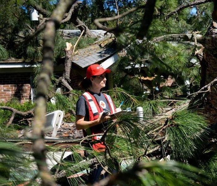 Wind damage from Hurricane Matthew
Since Hurricane Matthew first threatened the United States, Red Cross and community shelters have provided over 70,000 overnight stays.
This massive sheltering effort has provided nearly as many overnight stays in shelters as after Superstorm Sandy.
American Red Cross Response Along the East Coast:
Since Hurricane Matthew first threatened the U.S., Red Cross and community partners have served more than 137,000 meals and snacks, and provided 74,000 overnight stays.
The Red Cross has mobilized 3,000 disaster workers, 155 response vehicles—nearly half of our total fleet—and more than 100 trailers filled with water, ready-to-eat meals, cots, blankets, kitchen items, cleaning supplies and comfort kits, insect repellant, gloves, masks, shovels, rakes, coolers and more.
More volunteers, vehicles and supplies are being mobilized now to supplement relief efforts.
As conditions permit, Red Cross response vehicles will begin circulating through the hardest hit areas to begin delivering food and relief supplies
Even in areas where homes were on higher ground, further away from the water and less prone to flooding, wind damage from Hurricane Matthew caused older trees in historic and established communities in Georgia and South Carolina to fall onto homes, crushing them due to the age and size of the trees. Trees and large limbs covered streets and cars.
New Long-Range NJ Winter Forecast Released, And it's Not Good
10/3/2016 (Permalink)
A new long-range NJ winter forecast has been released, and You should be prepared.
If the latest long-range forecast is correct, it's a good time to start shopping for a new snow shovel.
AccuWeather, in its new long-range forecast, predicts it will feel like an extended winter for New Jersey and Pennsylvania as cold and snowy conditions will likely stretch into spring 2017.
Frequent storms across the northeastern U.S. — particularly in the Northeast — this winter may lead to an above-normal season for snowfall.
"I think the Northeast is going to see more than just a few, maybe several, systems in the course of the season," AccuWeather Long-Range Forecaster Paul Pastelok said in a news release.
Unlike last season, in which most of winter's snowfall came from a few heavy-hitting storms, this winter will last into the early or middle part of spring and will feature frequent snow events.
Pastelok said much of the accumulation will be in New Jersey, the Philadelphia metropolitan area and south of Washington, D.C. These areas will see a handful of changeover systems, where falling snow transitions to rain and sleet.
"But still, Boston, Hartford, along the coastal areas up into Connecticut and southern New England, they can still have a fair amount of snow," he said.
Overall, it's predicted that the region will total a below-normal number of subzero days, though the temperature will average 3-5 degrees Fahrenheit lower than last year.
Winter will slowly creep into the Southeast this season, as very mild air hangs on throughout the month of December.
However, the new year will usher in a pattern change as a sudden burst of cold air penetrates the region.
"I am afraid that we have a shot at seeing a damaging freeze in central Florida in mid- to late January this year," Pastelok said.
The Old Farmer's Almanac, meanwhile, has released its long-range weather predictions for the rest of 2016 and into 2017. If the publication's long-range forecast is accurate, we should expect above-normal temperatures this winter in the central part of the Atlantic Corridor region, which includes New Jersey.
AccuWeather, meanwhile, says a chill could spell disaster for the area's citrus farmers.
Cold air will once again retreat following January and the threat is predicted to shift to severe weather.
"Places like Atlanta, Chattanooga, even up into Roanoke, they could have some severe weather," Pastelok said. "But if the storm track is a little farther east, then you're looking more like Tallahassee to Savannah and, maybe, Charleston."
NJ Weather Forecast: Hazardous Weather Expected
9/30/2016 (Permalink)
Hazardous weather is expected this weekend as several New Jersey towns dealt with serious flooding on Friday.
The National Weather Service issued alerts warning New Jersey residents that persistent heavy rain could lead to flooding up and down the state.
Indeed, a Coastal Flood Advisory was posted for Hudson and Essex counties and along the coast to Salem County, with minor flooding possible.
Rainfall intensity is expected to decrease Friday, although we should continue to see rain through the weekend, according to the NWS.
Hurricane Matthew, meanwhile, appeared to be on a track heading north from the Caribbean, although forecasters say it's too early to say whether it will impact the Northeast.
Communities in North Jersey, down to the Jersey Shore and in South Jersey, meanwhile, dealt with a day's full of rain that flooded a number of streets on Friday.
Here is the weather forecast for the weekend:
Get free real-time news alerts from the Livingston Patch.
Enter email address
SUBSCRIBE
Friday: A chance of rain or drizzle. Cloudy, with a high near 66. Northeast wind 14 to 17 mph. Chance of precipitation is 40 percent. New precipitation amounts between a 10th and quarter of an inch possible.
Friday night: A chance of showers, mainly after 9pm. Cloudy, with a low around 62. Northeast wind 8 to 14 mph. Chance of precipitation is 50 percent. New precipitation amounts between a 10th and quarter of an inch possible.
Saturday: Showers likely, mainly before 2pm. Cloudy, with a high near 74. East wind 8 to 11 mph. Chance of precipitation is 60 percent. New precipitation amounts between a tenth and quarter of an inch possible.
Saturday night: A chance of showers. Cloudy, with a low around 62. East wind 5 to 9 mph. Chance of precipitation is 40 percent. New precipitation amounts between a tenth and quarter of an inch possible.
Sunday: A chance of showers. Mostly cloudy, with a high near 76. Northeast wind around 6 mph becoming south in the afternoon. Chance of precipitation is 30 percent. New precipitation amounts of less than a 10th of an inch possible.
Sunday night: A slight chance of showers. Mostly cloudy, with a low around 61. Chance of precipitation is 20 percent.
Monday: A chance of showers. Partly sunny, with a high near 75. Chance of precipitation is 30 percent
Tropical Storm Hermine Expected to Become Hurricane, Could Impact N.J., Forecasters Say
9/1/2016 (Permalink)
Tropical Storm Hermine is now expected to become a hurricane and may impact New Jersey this weekend, bringing several severe impacts that could be damaging to the area, forecasters say.
Hermine is expected to strengthen into a Category 1 hurricane before making landfall Thursday, according to The Weather Channel. Winds could exceed 70 mph when it hits Florida, and strong wind gusts could come to the New Jersey area by Sunday or Monday.
The storm, currently located over the Gulf of Mexico, is expected to move north toward the mid-Atlantic region this weekend, bringing with it a renewed threat of rip currents through the busy Labor Day weekend.
Beachgoers are being told that they should enter the water only if lifeguards are present, according to a briefing package put together by the National Weather Service.
Most rip current deaths occur on beaches when and where no life guards are on duty. Beach erosion is also possible, according to the briefing.
The storms could also bring these elements to the region:
- Strong Winds: There is a chance for tropical storm force winds - 39 to 73 mph - this Labor Day weekend as Tropical Storm Hermine, or its remnants, move north.
- The strongest winds should occur Saturday and Sunday. An inland path would result in lower winds.
- Heavy rain: There is a risk for heavy rain over much of the mid-Atlantic area. However, specific rainfall amounts are highly dependent on the eventual track of the storm. Recent dry weather will lessen the severity of any stream and river flooding that may develop.
- Street flooding and flash flooding are greater threats.
- Storm surge: It is still too early to determine if storm surge will occur with Hermine. A inland path would lessen the threat from surge. However, astronomical tides will be running high from the new moon on Sept. 1, so less onshore flow is needed for coastal flooding to develop.
- Timing: The second round of increased rip current risk (from Hermine) could begin Friday, then persist through Monday (Labor Day).
- Strong winds and heavy rain are most likely Saturday and Sunday, with showers possibly lingering into Monday.
Photos: The Weather Channel, National Weather Service
From the Clark-Garwood NJ Patch
Hazardous Weather Outlook
7/28/2016 (Permalink)
A severe thunderstorm watch was issued for N.J., as heavy rain and thunderstorms are expected Thursday and Friday and over the weekend, according to the National Weather Service.
The New Jersey counties impacted by the watch, which is in effect until 12 midnight, are: Atlantic, Burlington, Camden, Cape May, Cumberland, Gloucester, Hunterdon, Mercer, Middlesex, Monmouth, Ocean, Salem and Somerset.
A flash flood warning was also issued for all New Jersey south of Morristown, and as much as 2 inches of rain could fall beginning Thursday, mostly in South Jersey.
AccuWeather reports the storm system swinging up from the Deep South will bring downpours to the northeastern U.S. and break the back of an extended heat wave.
Downpours will extend northeastward from the lower Mississippi Valley on Thursday into Thursday night. Locally gusty thunderstorms will erupt along with the drenching downpours from parts of Virginia to southern New Jersey during this time, according to an AccuWeather release.
"The exact track of the storm system will be a challenge to predict," according to AccuWeather Senior Meteorologist Brett Anderson.
Here is what is expected on Thursday:
Here is what is expected on Friday:
Here is the forecast:
Get free real-time news alerts from the Livingston Patch.SUBSCRIBEThursday afternoon (North, Central Jersey): Partly sunny, with a high near 91. Light south wind.
Thursday afternoon (South Jersey): Scattered showers and thunderstorms, mainly after 4pm. Some of the storms could produce heavy rain. Partly sunny, with a high near 92. Light southwest wind. Chance of precipitation is 30%. New rainfall amounts between a tenth and quarter of an inch, except higher amounts possible in thunderstorms.
Thursday night: Showers and thunderstorms likely, mainly after 1 a.m. Some of the storms could produce heavy rain. Mostly cloudy, with a low around 75. Light south wind. Chance of precipitation is 70%. New rainfall amounts between 1 and 2 inches possible.
Friday: Showers and thunderstorms, mainly before 3 p.m. Some of the storms could produce heavy rain. High near 82. Southeast wind around 10 mph becoming north in the afternoon. Chance of precipitation is 80 percent. New rainfall amounts between 1 and 2 inches possible.
Friday night: A chance of showers and thunderstorms before 8pm. Mostly cloudy, with a low around 67. North wind 5 to 7 mph becoming calm after midnight. Chance of precipitation is 30%. New precipitation amounts of less than a tenth of an inch, except higher amounts possible in thunderstorms.
Saturday: A chance of showers and thunderstorms. Partly sunny, with a high near 85. Calm wind becoming southwest around 5 mph in the afternoon. Chance of precipitation is 30%. New rainfall amounts of less than a tenth of an inch, except higher amounts possible in thunderstorms.
Saturday night: A chance of showers and thunderstorms. Mostly cloudy, with a low around 69. Chance of precipitation is 40 percent. New rainfall amounts between a tenth and quarter of an inch, except higher amounts possible in thunderstorms.
Sunday: A chance of showers and thunderstorms. Cloudy, with a high near 84. Chance of precipitation is 50 percent.
'Drenching' Thunderstorms Will End N.J. Drought, Torrid Heat
9/9/2015 (Permalink)
WEATHER ALERT: 'Drenching' Thunderstorms Will End N.J. Drought, Torrid Heat
New Jersey has essentially gone 18 days without rain, and a heat wave has forced a number of school districts to close early.
It all should end tonight.
A torrid upper-90-degree heat wave that’s capped an 18-day drought should come to end Wednesday night and Thursday as drenching thunderstorms are expected to arrive in the region.
The National Weather Service has issued a Hazardous Weather Outlook for all of New Jersey, saying showers and thunderstorms producing heavy rain may lead to flooding in poor drainage and low-lying areas through Thursday.
”We are looking at a front this evening and we’re looking at some pretty good rain, just a lot of rain,” said Jim Bunker, a National Weather Service Meteorologist.
Despite having a “small trace” of rain on Aug. 31, New Jersey hasn’t had anything since Aug. 21, when .52 inches fell in the state.
A number of towns have imposed water restrictions, and a numbers of school districts closed early on Tuesday as they battle the effects of heat and drought.


 24/7 Emergency Service